Thursday, December 28, 2006

Wild and Scenic River...at last


O
n December 9, 2006, during the last three hours of its last session, the 109th United States Congress passed the "Musconetcong Wild and Scenic Rivers Act," which designates portions of the Musconetcong River as a component of the National Wild and Scenic Rivers System.

The Musconetcong meets the Delaware River just a few hundred yards below the Roebling cable suspension bridge that connects Riegelsville, PA with Riegelsville, NJ.

The Musconetcong is not merely one of many remarkable siblings in the Delaware River Basin family of streams, it is now officially an “outstandingly remarkable” river as defined by National Wild and Scenic Rivers Act, and as documented by the National Park Service and a host of other public and private organizations and individuals.

The Musconetcong resembles mother Delaware in so many ways. Each river richly deserved its wild and scenic designation for possessing so many outstanding historic, scenic, recreational and environmental features.

The Delaware forms the boundary between four states (NY/PA/NJ/DE); the Musconetcong between four New Jersey counties including Hunterdon, Warren, Morris and Sussex. Both rivers suffer to varying degrees from multi-jurisdictional fragmentation and their respective Wild Scenic River Management Plans prescribe a cure that if taken with should help ensure that a big picture approach prevails over the insidious small-town mentality. If I had my way all townships would be abolished! Watershed boundaries would replace the endless chain of meaningless little political fiefdoms that control and more often than not mismanage land use.

Two other streams within the non-tidal Delaware River Basin have been inducted into the nation’s wild and scenic hall of fame for rivers: the Maurice River, which flows into the Delaware Bay near the hamlets of Shell Pile and Bivalve, New Jersey, and the White Clay Creek which flows through the southeastern-most portion of Chester County, Pennsylvania into New Castle County, Delaware, where it meets the Christina River. The Christina runs into the tidal Delaware River near Wilmington.

Understanding the National Wild and Scenic River System is not easy. There are many nuances in the way each wild and scenic river is “managed” and there are huge differences in the various roles given to the National Park Service.

The Delaware River alone has three distinct flavors of National Wild and Scenic River designations that neatly match the three distinct non-tidal sections. The proposed Tocks Island Dam between Port Jervis spawned the Delaware Water Gap National Recreation Area in 1978. Here the federal government owns the land adjacent to the river and the National Park Service manages the land and recreational activities on the water.

The Upper Delaware Scenic and Recreational River was created a few months later, but 95% of the land adjacent to the river is privately owned. The NPS cannot regulate land use in this section of the river, but the National Park Service has primary responsibility for enforcement of river recreation. The Upper Delaware Council was formed with representation from municipalities from New York and Pennsylvania.

The Lower Delaware River between the Water Gap and Washington Crossing was designated just six years ago. The Lower Delaware River, Musconetcong River, Maurice River, and White Clay Creek are considered by the National Park Service to be “Partnership Rivers” meaning that they flow mainly through private land and the NPS is strictly limited to serving in an advisory role. Responsibility for on-the-water activities and land use remains with local, state and county governments and private property owners.

That’s a look at the bureaucratic side of our regional wind and scenic rivers. But what are the benefits of wild and scenic designation?

Foremost is that each river has a management plan that identifies the “outstandingly remarkable” resources that are to be protected and if possible improved, from water quality and recreational access, to historic structures and scenic vistas. River Management Committees bring people and organizations together to focus on the river and its tributaries.

The Partnership Wild and Scenic Rivers receive a modest, albeit shrinking amount of money from the federal government to implement their management plans.

Finally, wild and scenic designation makes a compelling case statement for the protection of specific resources. For example, the Delaware River Basin Commission has enacted more stringent water quality regulations for the Upper and Middle river sections, and is proposing the same for the Lower Delaware River.

The Musconetcong Watershed Association and other organizations have been pressing the NJDEP for a Category One water quality designation without success, but the new designation makes this a no-brainer that the NJDEP will have a difficult time denying.

The next post will explore in depth just what it is that makes the Musconetcong River so “outstandingly remarkable.”

Tuesday, December 12, 2006

Running the Rancocas...


Accepted an invitation from George & Leona Fluck to paddle the North Branch of the Rancocas Creek with the Outdoor Club of New Jersey (above pics shot by Leona). I have joined this club for trips on the Mullica River (1x) and Delaware River (2x) and it's a laid back group. These are SOUTH Jerseyans mind you. I mean we paddled by one cottage that proudly flew the colors of Old Dixie.

South Jerseyans are more laid back than their northern brethren; that is a good thing, especially on a river trip. They speak more softly. There is no need to virtually shout out the most mundane conversation, the way many of the northerners are wont to do. South Jersey, as a rule, is definitely more quiet than the north.

Anyway, George lent his Blue Hole Sunburst. It's a really nice solo whitewater canoe, very responsive, yet tracks well enough for a placid stream like the Rancocas.

We put in behind the Burlington County Community College -- an impressive new campus! -- at a nice county park boat launch complete with a plastic shelled composting toilet that even had a quarter moon design above the door. How quaint. Didn’t check out the inside, being a tree man all the way. I am told that the students hang here and sunbathe and swim, what a wonderful amenity for college students. The healing powers of the tea colored pure waters of the Pine Barrens are legendary. You've heard of the New Jersey Tea Devil?

The creek winds through beautiful Pine Barrens Mixed hardwood, pine, cedar and holly forest. The banks are sandy and there are a few pristine sand beaches. Much of this ten-mile section is wild looking, although the last 4 miles offers a visually entertaining potpourri of what were formerly summer cottages transformed into homes and cottages of all shapes and economic classes — from the land-hogging log McMansion to a few that would make nice illustrations in a Grimm Brothers fairy tale.

We took out an Smithtown (ville?) which was the site of a late nineteenth century bicycle factory. This man Smith operated an entire factory complex with comely company housing in a park like setting. He built a special bycycling monorail from the industrial village downstream to Mount Holly. Burlington County has one of New Jersey's truly outstanding parks departments and open space acquisition programs. We actually paddled what is now an official water trail, much of which is also paralleled by a land trail system. They keep it nicely pruned. No overhangs and no blocked channels.

The creek has a few floating mats of trash (mainly beer cans and plastic beverage containers) but it is mostly a clean river — appearance wise. The wall-to-wall cottages right at creek’s edge and an over-abundance of domestic ducks probably mean that this creek is not safe for swimming. OCSJ and G&L: thanks for the great trip and monster breakfast!

Saturday, December 09, 2006

OH HAPPY DAY…


Oh…mein….Godt!

2:00 AM Saturday, December 9, 2006

The US Congress passed legislation designating about 24 miles of the Musconetcong River for inclusion to the National Wild and Scenic Rivers System. The news came from Beth Barry, who succeeded me as the Musconetcong Watershed Association’s executive director in 2003. She and some stellar volunteers like Bill Leavens, Joyce Koch, Susan Dickey, Ed Secula, Cinny MacGonagle and others really made it happen, with the assistance of NPS (especially Jamie Fosburg, Paul Kenney and Bill Sharp), Heritage Conservancy (former staff Sharon Yates and Gary Bowles), and Quinn McKew of American Rivers. The latter group really helped see this thing through congress.

I am extremely happy, ecstatic, glad, even satisfied, if that is allowed. I began serving as MWA’s executive director in July 1997. Two months before that I led a group of MWA members, reporters, and Jamie Fosburg and Cassie Thomas of the National Park Service (Boston office) on a five-mile canoe trip between Hampton Park and Bloomsbury. The Philadelphia office staff already had their hands full with the Lower Delaware River, White Clay Creek, and Maurice River W&S studies. The canoe trip was more or less a kickoff for the Musconetcong Wild and Scenic River Resource Eligibility and Classification report, and that officially began about the time I began working for the MWA. The study and subsequent designation process took seven years to complete. It took two years to work through the gears of the House and Senate. All that remains is a signature from the POTUS (egad!).

That was a wonderful seven years of windshield surveys, aquatic insect sampling, hikes, canoe trips, and meetings meetings meetings. The rewards of that job were slim -- money-wise. Real slim. The true reward was working with salt-of-the-earth people in that greatest of northern New Jersey watersheds, people who stepped up to the plate for their beloved river and the land and the communities that surround it. What a pleasure it was to be given personal tours of every nook and cranny of the 165 sq. mile watershed by the watershed residents. We persevered through a monumental series of township meetings (I figure at least 100 meetings), obtaining near unanimous support from 25 of 26 municipal governments in parts of Hunterdon, Morris, Sussex and Warren counties. We jumped though this hoop TWICE: once to do the study and once again to secure resolutions of support for the river management plan and subsequent designation. Pohatcong Township was the one rogue mini-state run by wimps and terrorized by some idiot screwball farmers that refused to support both the Musconetcong and Lower Delaware River studies – mainly due to concerns about imminent invasion by the Blue Helicopters of the UN.

And best of all, we created the definitive report, a compelling case statement proving that the Musky is one of the “outstandingly remarkable” rivers in the land.

I’ve canoed about 3000 miles over the past 10 years, and at least a thousand of those miles was on the Musky alone. It is my favorite sanctuary.

Over the next week or so I’ll be writing about what the wild and scenic designation means for the Musky and the main goals of the river management plan. One initiative is to liberate the river from several dams, and that effort is already underway. This wonderful turn of events can only help.

Until then, you might want to visit this link to find a few interesting stories about the river and its protectors.

Friday, December 01, 2006

Welcome winter-like weather...


It's about time we get some cold weather and by golly it is finally upon us. Unfortunately it will be a bit too cold to paddle early next week, but there are other things to do like visit my mom, practice with the blues band and plan how to make some extra income this coming year.

If I can get out for two more river trips it's possible to pass 400 miles for the year. If not, there is always next year, but with the REAL JOB the bar will be lowered to 300 miles for 2007.

I was excited to see a few comments on my last post, but alas, it was merely junkmail solicitation. How desperate can they be? I know my blog looks like it might be widely read, but it isn't.

FOOLS!

Monday, November 27, 2006

Four hours on the Musconetcong...


That's what Eric, Wally and I did today, and that includes a leisurely lunch by Penwell Mill.

The above pics: Wally and Eric (kayak) pose in front of the Kings Highway Bridge. Much improved over the previous structure in every way. Pic #2 is the Pollution farm alluded to in the previous post. It is the single greatest source of pollution to the Musconetcong River. I'd rather see a housing development any day.

Beattystown to Hampton is about 12 miles of mostly swift current. Swiftly moving stream is reputedly what the Lenape called this river. It was running around 2.64' at Bloomsbury, and that is a perfect level.

This is such a fun stretch of water, it moves right along, but easy class one moving water allows for lots of sightseeing and there is so much to see -- natural and cultural beauty in abundance.

Sunday, November 26, 2006

Another Musconetcong Monday?


The pic, entitled "Just Me and My Pygmy Pony, Over By the Dental Floss Bush" was taken by Sharon on Veterans Day 2005, a 75 deg. Indian Summer escapade to Assateague Island National Seashore, one of my favorite camping and R&R destinations.

Last Monday the Musky was at 2.60', an ideal level. But the "real feel" temperature was around 35 deg. I found reasons to not paddle. It was windy, cloudy and cold, and the REAL JOB necessitates doing certain things on my DAY OFF. So what if I never even break 400 miles, at least 100 miles short of my goal for 2006. It's possible I'll reach 400 mi. but not at all likely. That's sad. I know some folks who regularly do over 1000 mi. per year.

But it's not the quantity that counts, in the end. Thing is all my miles are quality and the miles represent TIME ON THE WATER.

Tomorrow it will be a balmy 63 deg. and I will be paddling the Musconetcong River between Kings Highway Bridge in Beattystown and Hampton Borough Park, about 12 miles of varied scenery including mixed hemlock/hardwood, a bit of class 2 water, Point Mountain, lime kilns, farms, national historic register
hamlets (Beattystown and New Hampton) and structures (Pony Truss Bridge), and the ugliest farm in northern New Jersey, a virtual pollution factory of geese and steers. This is one farm I'd glady see converted to a cul-de-sac McMansion slum.

I'll be joined by Eric and Wally (a hopeful).

I haven't paddled this stretch for perhaps 3 years, before the Kings Hgwy bridge was replaced. I'll have a pic or two if the disposable camera doesn't take a swim.

Thursday, November 23, 2006

Rivers rising...

This storm is hanging around a little longer than expected. The Lehigh River, Brodhead Creek, Musconetcong River and Tohickon are all on the rise. The Delaware River will come up several feet but still not come close to flood stage, if it clears out tonight as predicted.

Nice Nor'easter...

Thappy Hanksgiving!


As Nor'easters go this one wasn't so bad. The Delaware River is just beginning to rise from 8' at Riegelsville and probably won't go up more than 3 or 4' by Sunday. The Musconetcong River stayed at a steady 2.60' all week and now has surged to 3' and rising. Discharge from Lake Hopatcong will keep it high enough for paddling.

We have several days of nice weather on tap, but according to AccuWeather a deep freezer full of Arctic air will pour down on us later next week; really really cold air.

Tuesday, November 21, 2006

Another nor'easter coming...

Let's watch this for potential impacts on streams and rivers large and small. It's a big question mark in terms of rainfall totals.

The Delaware River at Riegelsville has fallen back down to 9.34' which is a good thing. The ground is still staurated and that is not good.

Thursday, November 16, 2006

Eye-popping storm...

...for the upper Schuylkill River Basin that is. I just stumbled across the Tulpehocken Creek, a Schuylkill trib that runs into the river at Reading, PA. The creek at Bernville has so far risen from 2' to almost 8' today. According to the USGS the record is about 9.5 feet, set during Hurricane Agnes in 1972. Looks like it will surpass that tonight.

A floodwatch is in effect for Berks and Montgomery counties, which might as well be code for Schuylkill River Basin.

Go figure. I start a real job and am now blogging more frequently. Crazy weather makes me do it.

Big blow...


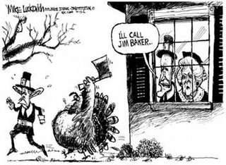
ABOVE: Republican for dinner

It isn't over yet but few stations are getting more than an inch of rain. The upper Schuylkill River watershed in Schuylkill County is an exception, some folks there have been pounded by nearly 4 inches of rain.

The streams and rivers are just now beginning to rise.

Let's hope we can dry out for a few days before the next storm. Eventually the jet stream will shift from the Pacific Ocean to the Arctic.

Wednesday, November 15, 2006

Not a nor'easter but...


The Delaware River at Riegelsville is pictured above, captured by Sharon Maclean (my love) at the start of the September 2005 Project River Bright. I am out in front waiting for the NJ Youth Corps members to catch up.


This impending storm is coming from the southwest and may bring up to 2" inches rain and more wherever thunderstorms occur. The action will begin after noon tomorrow.

The Delaware River at Riegelsville is at 7.05' and will likely rise up to twice that level depending on what falls in the upper watersheds, but that would still be a long way from flood stage, which is 22'.

Not surprisingly, most of the upper tribs on both sides of the Delaware are running higher than normal.

I don't believe there will be enough precipitation to pose a flood threat for the larger rivers, but some small flashy streams could rise out of their banks. Let's hope the predictions are relatively accurate. Most of the rain is supposed to fall well to the west.

Tuesday, November 14, 2006

Monday on the Musconetcong...

Good thing I have friends who can get out of work at a moments notice, like Eric Sween did today. He made it possible to paddle the Musconetcong on my day off from the vineyard. The river never did eclipse 2.50' so I bailed on doing the Saxton Falls section. It's just a little too bony for me at that level, specially with that soft spot underneath the Howler.

We met at the takeout near Bloomsbury, just downstream from I-78. Put-in at Hampton Borough park. 2.50 is an ideal level for this stretch of the river. Saw a few black duck, great blues, kingfishers, and other wise uneventful but very peaceful run. Balm for the soul.

Monday, November 13, 2006

A wimpy nor'easter...


Not much in the way of rainfall, but lot's of leaves fell.

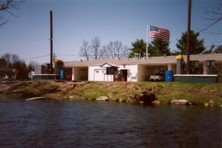
The Musconetcong River, pictured above at the car wash below Hackettstown, has actually gone down slightly (it's at 2.46' right now), which is a bummer. 'Twas hoping to paddle the whitewater section below Saxton Falls and that is more enjoyable when the river at Bloomsbury is above 2.50 and preferably closer to 3.00. It doesn't look promising for that stretch.

Tuesday is a day off and warm temps - must get on a river!

-- "He who hears the rippling of rivers in these degenerate days will not utterly despair."
Henry David Thoreau

Saturday, November 11, 2006

What kind of autumn do we have here?...

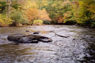
I shot the above photo facing upstream on the Musky between Pt. Mountain bridge and Penwell dam. October 1999. I think this pic illustrates why the Musconetcong River is one of only 3 national Wild and Scenic Rivers entirely within NJ. OK, just a technicality here. It has not been officially designated yet. It's eligible, but the bill languishes in the lameduck Congress. At least it's chief sponsor, a Warren County Republican Congressman was reelected. Ah yes! Warren County - a slice of central Pennsylvania and Alabama right here in Neew Jersey.

Oh, perhaps it's just a temporary pattern of wetter than usual weather, even for typically erratic November standards.

Looks like another 1-2 inches coming our way in the form of the second nor'easter within the past week. The Delaware River is actually falling and at 10:00 PM is around 8'. A few inches more rain over next 18 hours will take the river up to 15 feet or so.

All the tribs are up a little bit and some of the more flood prone piedmont streams might leave their banks. In NJ the Musconetcong at Bloomsbury is at 2.62, a perfect level for paddling. It will surge back up to near bank full and hopefully it will fall back to around 3 feet for a Tuesday trip on the upper river below Saxton Falls. It's a nice boulder chocked Class II section just below the flat and sandy terminal morraine. Anyone want to join us?

Thursday, November 09, 2006

Surging Delaware...


I thought it odd that the Delaware River at Riegelsville gage flatlined yesterday. Must have been a gage glitch. Now it is surging again...heading to 10 ft. and maybe 3 or 4 more feet before it levels off.

We have a few dry days coming up!

Wednesday, October 25, 2006

The rivers will rise again...

Delaware River running high below the Delaware Water Gap


A can't miss double whammy storm (see graphic here) is rolling towards the region and will be soaking us Friday and Saturday. It will be all rain, a combination of moisture from Hurricane Paul and a storm now over the Rockies (which at the higher elevations is a raging blizzard).

The Delaware River is at 5.70 on the Riegelsville gage, a bit higher than normal for this date. Most tribs are running near or slightly above normal. Everything will be running much higher by Sunday, but not at flood levels.

This Saturday I have a piano gig at the chapel in Millbrook Village, located in the heart of the Delaware Water Gap National Recreational Area. Undoubtably the nicest ride I will ever have for a piano gig, even if it is during the middle of a rain storm. After that I travel to Maine for a few days, driving a rental truck hauling the belongings of a friend. Upon return I will begin working for Amwell Valley Vineyards.

I will be a manager-in-training, which is an opportunity to learn every aspect of the business. It marks a return to my horticultural and arborist background and puts me outdoors quite a bit. I will be maintaining the vineyard, harvesting and helping the winemaker, as well as sales, events, marketing etc. They determined that my size 12 shoe size qualifies me as a promising MASTER grape stomper. I know that 250,000 pruning cuts must be done over next few months brrrrr...

Their Landot Noir and the Gewürztraminer are great and the vineyard is situated in one of the prettiest settings I've seen in the piedmont NJ (looks out over the Sourland Mountains).

The journal entries may diminsh over the next few weeks until I recover from the shock of working a real job.

Sunday, October 22, 2006

A cold winter's forecast?

Snow Day on the Musconetcong River


AccuWeather and the National Weather Service often part ways on both short-term and long-range weather forecasting. We can count on only one truth here: Each is making an educated guess and only when April 21 arrives will we learn who had it right, or for that matter if both had it wrong. AccuWeather is calling for a colder than normal January and February. NWS is predicting a generally milder than normal winter. I am hoping that NWS is more accurate. Mild winters are ideal for paddling the creeks and little rivers, and easier on the wallet too. The pessimist in me says AccuWeather will turn out to be more...accurate.

Here is what AccuWeather Chief Long-range Forecaster Joe Bastardi has to say:

AccuWeather.com Winter 2006-2007 Forecast calls for a cooler-than-normal winter along the East Coast and eastern Gulf Coast, and a warmer-than-normal winter from the western Great Lakes to the Pacific Northwest.

...Bastardi's research points to an El Niño that will remain at its current weak to moderate level, and may even weaken as the winter progresses. Because of this, a "typical" El Niño winter - such as the one predicted by the National Weather Service last week - that features warmer-than-normal temperatures across much of the U.S. is not as likely to occur.

One of these factors that Bastardi and his team expect to shape the upcoming season is the formation of a high pressure area over Greenland or northeastern Canada. This would force arctic air down into the Northeast. If this occurs as expected, the Northeast could experience severe, prolonged cold - ten days or more of temperatures averaging five to ten degrees below normal - during the middle to late winter, most likely during the month of January.

"Signs are pointing to the possibility of a rough conclusion to winter for the Northeast," said AccuWeather.com Director of Forecast Operations Ken Reeves. "Examining past years where we see similar patterns to what we expect this winter bears this out. For example, the winter of 1992-1993 was moderate until early February, when it then became colder and snowier, and culminated with a harsh blizzard on March 13. Another of the winters we see a parallel to is 1957-1958, which again began more moderately, and concluded with significantly colder temperatures and major February and March snowstorms."

Bastardi forecasts a wetter-than-average swath from Southern and central California, to the southern Plains and Southeast and up the East Coast, because an expected active subtropical jet stream will send storms on a track across the southern U.S. and likely ensure wet weather in the southern tier of the nation. How this moisture times itself with the arrival of colder air will determine how much snow the Northeast can expect, but winter is likely to be snowier than normal in the region - a mainstay of all winters since 2002. Very warm water relative to normal off all coasts provides ample moisture for any storm and timed with cold air, would lend itself to heavy snowfall in the higher elevations of the Southwest and Southeast, and also the chance for some major coastal storms on the East Coast.

For NWS/NOAA go here.

Thursday, October 19, 2006

Upper Tohickon rocks rock...


Arlene Curley is a great paddling partner. She doesn't talk much. The incessant gabbing of paddling gadflies is what keeps me away from many club trips. Babbling paddlers miss so much of the spirit of a waterway, and they scare the wildlife away too.

We met at the Ralph Stover SP take-out and put Arlene's kayak on top of my car and headed up to the Nockamixon Lake dam for the put-in. The creek was running at 2.60' at the Tohickon Pipersville gage which is a decent level for the upper Toh. It was a balmy 71 deg. air temp and water was about 60 deg.

Spectacular fall colors of hickory, maple, purple asters with the beautiful red shale and blue jingle cliffs as backdrop. The aroma of falling leaves was intoxicating. The upper creek has many beautiful shale cliffs, not a high as the lower, but unlike the class 2 and 3 lower, one actually has time to savor the scenery.

This is a hidden away stream for the most part and always has lots of wildlife. On this trip we saw many wood duck, a great blue heron that we chased all the way to the Stover dam, an osprey, red tails, a few nervous white tail deer (with racks), and a chubby beaver. The beaver never saw us coming. We watched in silent amazement as it crawled up a 50% sloped muddy bank. It finally heard my paddle as I clumsily tried to get upstream to the beaver's eddy. It saw Arlene sitting just a few feet away and FAINTED! No lie! Well, maybe lie. It literally fell back into the river, totally shocked I am sure, as beaver are very alert and wary animals. I don't think either of us have been that close to a beaver that was on the shore.

Strainers are a serious problem on the Upper Toh. In particular, there is a Paul Bunyan Ash laying across the main center channel of the creek about a mile or more below the second bridge. This is a dangerous strainer as the current is swift and channel narrow. One can pull out on river right at a braided fork (too low to enter at this level) about 20 yards upstream from the strainer and drag the boats around. At 3.00' or more the right braided channel can be run around the island. One can also pull over on river left and take another braided channel or drag around on that island, but by the time you see the big strainer you probably have missed the river left option.

Further down below Rt. 611 the river splits again with the main current heading right at the top of an island. Both of us approached this a bit too casually for our own good resulting in an unscheduled swim session for Arlene. No harm done, just a nice invigorating baptism. I was almost jealous. Last time I was "baptized" was a trip down the Tohickon in January '06 with Harold Deal. I tried to wiggle around a bridge strainer and the eddy sucked me into the abutment and the violent collision tossed me out of the Howler. Made for a chilly trip.

One more potentially dangerous strainer area that has worsened since my last visits (January and March) can be found at the broken mille dam just above a small bridge. River right, which we chose was 98% obstructed, but we were able to do an upstream ferry and get over to the main channel. However, we saw that the river-left channel that goes over the broken dam also has some strainer build-up. It is passable, but it needs to be approached carefully.

The big Stover dam portage was easy and the last few miles feature a delightfully bouncy stretch of water.

This is not a good stream for novice paddlers due to the many blind bends and strainers.

Monday, October 16, 2006

Crashing down the Mullica...


Rivergeek inspects a beaver lodge on the Mullica River during a winter '06 trip with the Outdoor Club of South Jersey.

I have been paddling solo for so long that I almost forgot how to handle a tandem canoe. Yesterday I was forced to re-learn quickly on the Mullica River in the New Jersey Pine Barrens. Sharon was my bow paddler and she can do a good draw stroke, perhaps the most important stroke on this windy, narrow and surprisingly swift stream. We were joined by Eric Sween who paddled a kayak

The stream gage read about 1.90' and any higher and we would not have squeezed under some of the low hanging trees, and I mean we were forced to lay flat in the boat to avoid getting stuck.

This is a gorgeous river that starts out below Atsion Lake at about 4 feet in width. It is an extrordinarily meandering river that flows through Atlantic White Cedar and hard wood mixed forest as well as the classic shrubby Pine Barren habitat. At one point the river opens into a lake-like savannah that features many large beaver lodges. The Mullica is a wilderness experience through Wharton State Forest, devoid of buildings and highways. It is really quiet except for the occasional intrusion of the fossil fuel addicted, stinking white trash redneck ATV rider.

Trees and shrubs grow right out over the water, making for tricky paddling. My hat was knocked off at least six times, one resulting in a near hat-sinking, but I don't mind wearing a wet hat when it's sunny and over 60 degrees.

At one point Sharon and I almost tipped, she was actually half in the water and half in the boat but I somehow got us righted, miraculously. We went flying around one of the dozens of blind curves and sideswiped a tree that was near the right shore. The only thing that prevented a cold swim was that I managed to grab the tree and force the boat back up. By then we had taken on several inches of water and became very tippy, but we found a place to dump out the water.

We put in bekow Rt. 206 at 10:30 AM and took out at Pleasant Mills about 4:40 PM (with a half hour lunch break). My understanding is that this is a 12-mile run, but it felt more like 20 (it's really close to 14 miles). That is because we were forced to duck, squeeze and careen our way through the narrow and sometimes obstructed stretches of the river.

The Pine Barren rivers are truly beautiful. But paddling one of these streams often involves a degree annoying struggle with downed trees and overhanging vegetation. A taste of the Mullica has increased my appetite for the local upland streams that I repeatedly paddle without ever having my hat knocked off my head.

The next rainstorm will bring the Musconetcong River and Tohickon Creek back up to runnable levels.

Thursday, October 12, 2006

Tougher buffer rules rule...


The following press release from Delaware Riverkeeper announces that the 300 ft. stream buffer that applies to state designated category one waterways has been upheld by the NJ Supremes, a major and welcome defeat for sprawl mongers like Hovnanian and Toll Brothers.

Streams that are not designated category one receive a 150' buffer from new land development. None of the rules apply to agricultural activities. Indeed, it has been revealed that NJDEP has abused a loophole that allows developers to apply the 150' rule to category one streams (instead of the required 300') on land that is being converted from agricultural use to development. A review of NJDEP's sneaky policy has been promised.

NJ now has some of the tougher buffer requirements in the nation. It is pretty much inconceivable that largely rural states like PA and NY will adopt similar laws. Only a few PA municipalities within the Delaware River Basin have adopted strong buffer rules, Solebury Twp. being an example.
________________________________________
300 FOOT BUFFER RULE UPHELD

NJ Supreme Court denies developers' appeal of stormwater regulations

The New Jersey Supreme Court denied the New Jersey's Builders Association petition challenging the 300 foot buffer rule contained in New Jersey's stormwater regulations adopted in 2004.

"The Appellate Division decision upholding the 300 foot buffer rule stands. We were notified late yesterday that the Supreme Court has rejected the New Jersey Builders Association Petition for certification of the buffer rule", said Carter Strickland, lead counsel in the case and Professor of Law at Rutgers Environmental Law Clinic.

New Jersey adopted sweeping stormwater regulations in 2004, which included a requirement for 300 foot buffers on either side of Category 1 streams and their drainage area. Environmental organizations in New Jersey worked for many years towards the adoption of the regulations, which have been in effect for over two years. The New Jersey Builders Association (NJBA) opposed the regulations and challenged DEP's authority to issue the regulatory requirement claiming the buffer requirement functioned as a "no build" provision "directly regulating the use of land without regard to stormwater control or management and
promulgated by the DEP without state-wide land use regulatory jurisdiction."

The Appellate Court rejected the argument In April 2006, recognizing DEP's broad authority for protecting water quality and ecosystem health. The Appellate Court stated, "The Legislature, in variety of measures, has given the DEP a wide array of power to address water
quality and pollution concerns beyond traditional floodwater control, and to promulgate rules to protect the waters of the State." The correlation of riparian land use and water quality was noted in the Appellate ruling.

"The Supreme Court's denial to hear the NJBA's challenge reaffirms DEP's powers and sets national precedent for stormwater management", said Maya van Rossum, the Delaware Riverkeeper. "The lesson learned here is that environmental regulators can and should approach stormwater management in a comprehensive manner, preventing runoff and
pollution by keeping natural systems intact", said van Rossum.

"This validation sets the record straight about the importance natural stream systems play in the protection of water quality and stormwater management", said Eric Stiles, Vice President for Conservation and Stewardship, NJ Audubon Society. "This is great news for our streams
and their habitat".

"This decision will strengthen protection of local waterways and help municipalities plan for protection of their stream corridors," said Sandy Batty, Executive Director, Association of New Jersey Environmental Commissioners.

Other states across the nation have been watching the NJBA's attack on NJDEP's powers to regulate and protect the environment. The decision marks the end of the road for this legal challenge.

Wednesday, October 11, 2006

We've only just begun...to paddle


The Delaware River at the Riegelsville gage is down to about 4.70 and slowly falling. Tributary streams are going down as well.

I am contemplating a trip on the Mullica River this weekend, let me know if you want to go. The Pine Barrens streams are lovely this time of year when there is enough water.

The cold weather paddling season is about to begin. It's the time of year that the small streams are high enough to paddle and the big rivers are ofter too windy. More importantly one can paddle in relative peace and tranquility, which is the way it's supposed to be. That is because all the fossil-fuel addicted jetskiers are absent and there are few power boats. These jerks can make paddling the river a lousy experience, and that is pretty hard to do.

The rivers and creeks all take on such a different look with the dormant and dead vegetation, frost, ice formations, and snow. The winter light is so beautiful on the water.

My favorite late fall through early spring paddling stream is the Musconetcong River, which cuts deeply into the limestone valley. I have paddled on the Musky in extremely windy weather (30 mph) and the tree tops are blowing like crazy, but there is only a wisp of a breeze on the water. A downside is that the Musky flows west, and with the sun lower in the sky this time of year, forgetting sunglasses can be a major mistake when paddling in the afternoon.

The Tohickon Creek (shown in the above pic) is another sweet local stream to paddle in cold weather, although it doesn't hold water nearly as well as the Musky and that is totally a function of geology.

The cold weather paddling requires a lot more effort in terms of preparation, especially having adequate clothing. I use a fleece-lined wetsuit that is quite comfortable, wind and rain resistant and padded in the knees for the obligatory kneeling. Under that I wear silk underwear and over the wetsuit a fleece jacket, and if cold enough a supplex nylon anorak. The biggest challenge for me is keeping the hands and feet warm.

After all the problems we have experienced with high flows I can now say: Here's to a wet fall!

Thursday, October 05, 2006

RIVER CLEANUP SEASON ENDS


Operation River Bright has been postponed until next year.

We wanted the river to get back down at least to the 5' range, preferably 6 inches lower than that. Instead it has shot back to over 6' and still climbing; it will almost certainly be well-above 5’ on Saturday (Riegelsville gage). At five feet + the river is not particularly unsafe for a downriver trip (3.5’ is low flow at Riegelsville gage), but at over 5’ it can be hazardous to be making repeated landings on shore in search of trash because the river is up in the shrubs and trees – creating what paddlers refer to as "strainers" (let's the water through but not you). This greatly increases the possibility of folks dumping and even pinning their boats.

We have excellent safety and river rescue people on these river cleanups, so if we had a HOT sunny day in store maybe we could live with the water level being a little high but...

The air temp at the planned registration time will be in the upper 40's and the high is predicted to be about 62 deg. with a 15 mph northerly wind, and water temp will be about 60 deg. For those not wearing wool, fleece, wetsuits, dry suits etc., hypothermia becomes a serious concern. And of course, the people least likely to have proper river attire would be the most likely to take an impromptu swim complete with blue lips and chattering teeth.

Early October usually brings gorgeous weather and low water levels. Not this year. Indeed, 2006 has been a year of high flows and crazy weather, including of course the 4th all-time record flood in early July, which brought a new plague of trash and litter. We will all hope and pray for no more floods I am sure, and get back out there to remove as much trash as we can from this world class river in 2007.

On behalf of the Delaware River Greenway Partnership I offer a heartfelt thanks to all who have helped or otherwise supported Operation River Bright this year. Our September 23 cleanup between Bulls Island and Hendricks Island greatly improved that trash-plagued stretch of river.

A special thanks to the National Canoe Safety Patrol - Lower Delaware Chapter, New Jersey Youth Corps of Phillipsburg, American Canoe Association, Mohawk Canoe Club, National Park Service, Lower Delaware Wild and Scenic River Management Committee, Keller’s Landing and Delaware River Experience, Hunterdon County Parks & Recreation, Lazy River Adventures (canoes), PA Department of Conservation and Natural Resources - Delaware Canal State Park
(for supplying a dumpster, gloves, bags and encouragement), ShopRite of Flemington (gloves, bags, bottled water), and Allied Waste (for offering a free dumpster).

See you on the water....

Monday, October 02, 2006

River rises...slowly falls


NJ Youth Corps members take delight in 2-mile river trip to Hendricks Island during the September 23 river cleanup. Their smiles changed to furrowed brows at the sight of the glacial piles of trash infested flotsam & jetsam that awaited them on the island.

OPERATION RIVER BRIGHT October 7

CALL TO BOATERS - WE NEED HELP! .......It looks like conditions will be favorable for the river cleanup this Saturday. I am doing my best to intervene with the river gods and goddesses to lower the water about a foot, and bring a sunny day for folks who are coming out to make our beautiful river even more beautiful by attacking the blight of trash and litter that degrades the Delaware River.

The Delaware River rose over a foot-and-a-half at the Riegelsville gage on September 30, which was scheduled to be the second '06 river cleanup. Conditions were marginal at best that day, to the point that we may have cancelled anyway. Now it's looking like October 7 will turn out to be a much better day in the important ways.

The river has flat-lined after falling back down to 5.74' and that is -- as always -- due to the higher than normal flows in many upstream tributaries. Once again the Poconos received most of the precipitation, and the Lehigh River being the second largest tributary in flow and watershed size (Schuylkill River #1), exerts a profound influence on the Delaware in oh-so-many ways, and not usually in healthy ways.

Right now the Army Corps is blasting water from FE Walter Reservoir, a flood control dam situated a few miles upstream of Whitehaven, PA, at a rate of 1300 cubic feet per second, an increase over the previous three days of between 700 and 1000 cfs continuous releases.

The NYC reservoirs are near capacity (98%). If and when the agreement to keep the reservoirs at or below 80% is approved by all parties that will change.

On the Jersey side the Flatbrook, Paulinskill and Pequest are flowing slightly higher than normal and the Musconetcong River isn't even canoeable at 1.74.' On the PA side the Tohickon is falling back to normal low levels, and the Lackawaxen River, Bushkill Creek and Brodhead Creek are running higher than the seasonal mean, but slowly coming back down.

All this means that the Delaware River will cease flatlining as soon as the upper watershed streams fall, and it will fall even more when the Army Corps closes the gates at the FE Walter Dam.

The Delaware River Basin Commission's monthly hydrologic report summarizes rainfall data for stations near the river at Montague, Trenton and Wilmington. Unfortunately this river-centric data set does not tell the true story as it shows Trenton with the highest total. The upper basin received much more rain since January 1 according to NWS data. For example the Mt. Pocono station records 12.63" total rainfall above the yearly average so far this year (about 5" more than Trenton on the Delaware).

The great news is that we could have been - but weren't - hammered by 2 or 3 big storms that were pushed to the northeast to pound the British Isles and maritime Canada.

Friday, September 29, 2006

Once again...


Operation River Bright will take place October 7

River cleanup vols will pass by the Nockamixon cliffs between Riegelsville & Upper Black Eddy.

The postponement of the September 30 date may turn out to be a smart move afterall as the storm last night dumped heavy rain on the Poconos.

The gage at Riegelsville is at 4.63 this morning and heading upwards. Pocono streams such as the Bushkill, Brodhead and Lackawaxen are all still rising.

Looking forward to a run of chilly but mostly dry weather this weekend and into next week.

From the Pocono Record:
Reservoirs in N.Y. plan immediate drawdown
Agreement expected to mitigate Delaware floods
Dan Berrett
Pocono Record Writer
September 28, 2006
WEST TRENTON, N.J. — The governing body that monitors the Delaware River agreed on Wednesday to immediately lower water levels in the three upstate New York reservoirs that feed the river.

The Delaware River Basin Commission authorized a "trigger mechanism" that would be in effect from now until May 31, 2007. It would mandate regular releases from the Cannonsville, Pepacton and Neversink reservoirs when their combined storage levels reach 80 percent.
______________________

Keeping the reservoirs below 80% will mean a few inches less of floodwaters, which could be meaningful for some property owners. Unfortunately too many people operate under the illusion that flooding can be controlled or stopped by better management of the water supply reservoirs.

There is only one indisputable truth that we can count on:
Floodplains flood.


Sunday, September 24, 2006

Operation River Bright #1


Despite threatening weather at the start, the river cleanup went forward. More details to follow.

The photo shows members of the New Jersey Youth Corps and National Canoe Safety Patrol off-loading trash taken off of Hendrick Island by a homemade canoe barge.

For more pics go here.

Wednesday, September 20, 2006

Delaware River cleanup...new schedule

OPERATION RIVER BRIGHT

Where: Bulls Island State Park boat launch

When: Registration is 8:30 AM this Saturday (23rd) at Bulls Is. We aim to be done and eating pizza by 1:30 PM

What to expect: Wet feet. This is a RAIN or SHINE event!

What to bring: your own equipment (PFDs must be worn while on or in the water)

What we provide: Snacks (granola bars), bottled water, work gloves (choice of rubber or cotton), trash bags, lunch (pizza)

Strongly Recommended: Sturdy shoes, long pants, extra clothing


I am 98% sure that the weather and river level will allow the September 23 river cleanup to proceed (knock wood). The Delaware rose to 9’ last weekend and we need the river to fall at or below 5’. It needs to drop another foot or so, and it almost certainly will given the rain-free forecast. There is a slight chance of showers in the Saturday forecast but this event will go as planned unless we have a monsoon!

PLEASE NOTE: Right now it looks like this Saturday’s cleanup will be more than adequately staffed. HOWEVER we are lacking volunteers for the September 30 cleanup between Riegelsville and Upper Black Eddy – a more traditional downriver cleanup.

This Saturday we plan to launch at Bulls Island SP and work the shorelines of NJ & PA down to Hendricks Island. A trash dumpster, which was provided by the Delaware Canal State Park (PA DCNR), will be located at Virginia Forrest recreational area, which is adjacent to the top of the island. Most of us will be taking out there. FYI: Virginia Forrest has toilet facilities, so folks can take a bathroom break as needed.

Please plan to be at the registration on time so that you can do the shuttle and be back on time for a brief safety and logistics talk before launching (planned for 10:15 AM). Shuttle arrangements will be made on the fly. Those of you with vans or larger vehicles can hopefully bring folks back up to the put-in.

Details about the September 30 river cleanup will be posted next week.

Friday, September 15, 2006

September 16 River Clean-up Postponed


Sharon Maclean studies the terrain on Lynn Island durng a trash reconnaisance canoe trip. The recent flood caused dramatic changes to the riverscape.

NEW SCHEDULE

Saturday, September 23 Bulls Island to Hendricks Island
Saturday, September 30 Riegelsville to Upper Black Eddy


Drat! Another rainout...


The last Operation River Bright to be postponed was the one unfortunately scheduled for the week after Hurricane Ivan hit, causing the first of what would turn out to be a spate of three consecutive record setting floods.

This is a mere postponement due to a 2-foot + rise in the Delaware River (Riegelsville gage), which was at 4' before the spike. It's already above 6' and looks like it will peak between 7' and 8'.

What can I say? It's been that kind of year weather-wise. And the Poconos got another monsoon. Streams up there are extremely high and that has impacted the Lower Delaware. The Brodhead Creek went from 200 CFS to 5,000 CFS in less than 24 hours yesterday. On the NJ side the Paulinskill, Pequest and Musconetcong saw big spikes too, although not as dramatic as the Brodhead or Bushkill.

When I went to bed last night I really had no idea that we'd need to postpone this Saturday's cleanup because of high water. Anything above 5' becomes problematic and 6' is out of the question, and for what we have planned on Hendricks Island (involving barges and ropes) above 4.5 would be a problem. It's not that the river is unsafe at 6' but sending people repeatedly into the river banks to collect trash would be irresponsible (strainers).

Fortunately we have quite a talented team of volunteers raring to go so hopefully folks can be flexible with their schedules.

I have proposed the Hendricks/Stockton river cleanup (originally scheduled for the 16th) be put off until next week (23rd) and the Riegelsville - Milford cleanup will be held Sept. 30.

A land-based cleanup may be scheduled if the high water problems persist. But I am optimistic that the Delaware will come back down to a nice level based on the forecast for the coming week.

PS: Sunday is the American Canoe Association - Delaware Valley Division picnic and annual meeting at Round Valley (anyone interested in joining us please contact me or GO HERE.

Thursday, September 14, 2006

OPERATION RIVER BRIGHT...


WE NEED YOU - For the War on Trash
Saturday September 16 and Saturday, September 23
Rain or Shine

Project River Bright was created in the late 1990's by Carrie Brownholtz, formerly of Telford PA, for the Delaware River Greenway Partnership. I helped out as a safety officer for all of those events, which from a safety standpoint, were most decidely understaffed. Carrie left for Oklahoma to live with the Delaware Indians and I took over River Bright in 2003. My first cleanup was wiped out by Hurricane Ivan, first of three consecutive flood events.

Two years ago Major George Paffendorf (US Army Ret.) of the NJ Youth Corps came up with the moniker "Operation River Bright." I liked the military sounding version of River Bright, because in a way we are waging war on trash, and despite our best efforts there has never been more ugly trash in this beautiful river, thanks to the July '06 flood and -- lest we forget -- the sources of the trash, which would be the people who live near and/or recreate in the river and its urbanized tributaries.

The untold story of the recent flood is the incredible influx of manmade trash that has been carried into the river from storm drains, streets, roadside ditches and tributary streams from places as far away as Hackettstown, NJ, Hancock NY, and Lehighton, PA. Trash from everywhere upstream in the watershed ends up down here in the Delaware River, and what doesn’t get hung up here continues down to the bay.

I suspect that the existence of this trash in and along the river and its islands presents a greater threat to the ecological health of the river than any of the other usual suspects including wasterwater treatment facilities and polluted runoff. In particular, plastic trash is now found everywhere, especially beverage containers, but also tarps, and construction and silt fences.

According to an article that appeared in Waste Management World, each day in the US more than 60 million plastic water bottles are thrown away. Most end up in landfills or incinerators, and millions litter our streets, parks and waterways. Anyone who travels down the Delaware River will not have any difficulty believing these statistics.

Over the next two Saturdays heavily armed armadas will sweep the river banks and islands between Riegelsville and Stockton looking for trash and manmade debris. Our number one priority will be anything that is plastic. But we also expect to collect propane and gasoline tanks, styrofoam objects, tires, glass containers and odd objects such as dolls, bowling balls, and toilet seats, etc.

The Operation River Bright is an American Canoe Association santioned event. The cleanups would not be viable without the help of the National Canoe Safety Patrol - Lower Delaware Chapter. In particular, George and Leona Fluck of Piney Paddlers fame have provided invaluable service to these cleanups. This year, George has put considerable time into the planning of special methods to get trash from Hendricks Island to the dumpster at Virginia Forrest Recreational access. The implementation of these plans should prove to be interesting, since it involves setting up zip lines and creating a barge or two.

A report on this weekend's Hendrick Island cleanup will appear early next week.

Thursday, September 07, 2006

Go with thee Flo...


The above photo taken yesterday shows one of the target areas on Hendrick Island for the upcoming September 16 river cleanup.

... All the models have Florence heading east by the weekend, whacking the Canadian Maritimes and sparing us. Forecasters are hopeful, all say remain vigilant, because the projected path of Flo is based on... air?

AccuWeather is even giving the odds on Flo, foretelling a 90%/10% chance that she will go east. This morning it was 75/25. Still, that 10% is reason to be concerned.

If the forecast for the next several days turns out to be true, river will be going back down to 4' and conditions will be ideal for a river cleanup or two (cleaunp information and trash photos will appear over the next several posts in this Journal).

Dave Soete of the Upper Delaware Council forwarded this bit of promising news. Read this article, particularly if you are in the floodplain of the Delaware River.

Alliance has plan to manage dam releases Columbia students balance water supply and fisheries By TOM KANE UPPER DELAWARE RIVER - There’s a solution to the problem of water releases from the three regional reservoirs that supply water to New York City, and it’s relatively easy to carry out. So says Peter Kolesar, a river valley resident and a Columbia University professor. “We have a plan that will save businesses and homes along the river from flooding, and will satisfy fishermen without limiting the city’s water supply,” Kolesar said. The plan is an end-product of an alliance, formed last January, of Trout Unlimited, the Nature Conservancy and the Delaware River Foundation, Columbia University professors and students from the business and engineering schools. Kolesar and his students have produced several computer models on the releases issue and come up with, they think, a solution. The problem centers on the practices of the city’s Department of Environmental Protection (DEP), which controls the management of the dams and reservoirs that feed water into the city. “The city is very concerned that the drought of the century may start at any time and, if they aren’t careful about how much water they release, there will not be enough water to satisfy the principal reasons for the dams and reservoirs≤to supply water for the people and businesses of the city,” Kolesar said. Kolesar and his alliance assert that the northern section of the Upper Delaware gets short changed in the way releases are carried out. “There are two parties that benefit from the current release policy: the city and the down-basin states,” he said. Kolesar defined the down-basin states as those areas along the lower river in New York, Pennsylvania, New Jersey and Delaware. The release method his group is championing would smooth out the releases by releasing more water during a wet summer. “When you have more water, release more water,” he said. “When you have less water, release less water. Make more effective use of the Delaware’s water by spilling less. This also helps mitigate flooding. Don’t operate the river like a faucet. Maintain smooth transitions between water levels. Keep it simple.” This method, which he calls the Seasonal Adaptive Release Policy, can bring major improvement for the Upper Delaware fishery and ecology at little or no increase in risk to the city or down-basin users of Delaware River water. If it were followed, it could greatly benefit the fishing economy of Delaware County, NY, because it could extend the fishing season, he said. “This policy protects the fishery in wet summers by releasing more water than the current policy, but in wet summers adequate water is available to do this,” he said. “In wet summers, the adaptive release policy creates modest additional reservoir voids in the late summer and early fall that can offer some flood mitigation.” The policy allows the release of more water for the ecology because it spills less, he said. Kolesar admits that the details of the policy have to be worked out by all concerned groups. “The city and New York State are actively considering this plan, which has merit,” said Robert Tudor, Assistant Director of the Delaware River Basin Commission (DRBC). “It is intriguing that this plan focuses on three main concerns: the city water supply, the fisheries and the downstream communities. We’ve had three 100-year floods in two years, so we need to examine releases and spills. The technical work has yet to be done so all the parties to the 1954 Supreme Court decision will be involved in this decision.” “The main obligation of the DEP is to ensure the ample supply of water to the city,” said Charles Sturcken, director of public affairs. “Since we have had so many unusual floods recently, it is important that we re-examine the releases policy. In the next few months, we will join with the Delaware River Basin Commission and the River Master to consider these suggestions.” Sturcken said that in May of 2007, there would be a review of the releases policy, which is routinely done every few years.

I have read that there would potentially be a 2.5 feet lowering of the floodwaters if the reservoirs were voided enough to create more capacity and still not jeopordize water supplies. Responsible reservoir management would be a major benefit for most flood-prone property owners along the river for the 30' flood, but that would not prevent a major flood from occuring. Even with a 2.5 drop that could result from lower reservoir levels, a flood like the April '05 or certainly the 1955 event would still innundate the usual places (New Hope, Yardley, Byram, Harmony Station etc).

Wednesday, September 06, 2006

Which forces will steer Florence?

The Delaware River at Riegelsville has fallen below 5' again - praise be! Tribs are falling back to seasonal norms.

I feel like this journal has become a weather blog with the hurricane season controlling the subject matter. There are only about 6 or 7 weeks left until we slip by the tropical depression making season, and into the ice and snow.

AccuWeather provides an excellent graphic depicting Florence and the very different paths it may take depending on how the current high pressure system plays out.

AccuWeather Meteorologist Lisa Wieser says:
".....there are two scenarios which could play out. The first is the one most of us are probably hoping for, that Florence will curve away from the East Coast. For this scenario to occur, the high pressure system in the central Atlantic would have to weaken as it shifts eastward during the weekend. The clockwise flow around the high would curve Florence to the northeast before it reaches the coast early next week. At the same time, an upper-level trough is expected to move across the Great Lakes region into the Northeast early next week. This trough's counter-clockwise flow would help keep Florence away from the coast as well. The second scenario, the more dangerous situation, involves the Atlantic high strengthening and expanding westward over the weekend. This would send Florence on a nearly due-west track right into the coast early next week, and slow the eastward progress of the upper-level trough which would push Florence away."

If Florence stays off the coast and heads out into the Atlantic we will have good conditions for Operation River Bright on September 16. If it heads to the coast....well, we may be doing a land-based cleanup of river accesses and parks.

Stay tuned.....Florence will show her hand this weekend.

Tuesday, September 05, 2006

Rain Rain go away, come again December


NWS is predicting 1 - 2 " rain today and tonight along with flood watches for creeks in the lower Delaware River Basin (Brandywine, Assunpink and others).

All the streams and rivers basin-wide are running a bit higher than the daily median discharge. The Delaware River at Riegelsville is about 1.5' higher than it was prior to Ernesto. It must fall back to below 5' for the upcoming river cleanups! It may well do that so long as Tropical Depression 6 does not become a hurricane. (Note: As of 11:oo a.m. #6 has become Tropical Storm Florence)

AccuWeather seems to think this may occur.
"The stage is set for the biggest hurricane so far this year. The actors know their parts. Very warm water from the central Atlantic to the Bahamas will play a big role. Another lead character is the existing westerly flow across a segment the central Atlantic. Its part in the play will be short as a big high takes center stage to the north. Factoring all these elements together, there is a strong likelihood that Tropical Depression 6 will be a Category 2 or 3 hurricane later this week."


Yesterday I was joined by Sherry Maclean and Eric Sween for a sweet run down the Musconetcong River between Hampton and Bloomsbury. The Musky was just high enough at 2.25'. It is a bit scratchy at that level, but hey, Sherry and I were in Erics fiberglass barge. We chased a pair of osprey down the river below Asbury. Much solitude and seclusion on this stretch of water. Restores the soul.

The US Congress is coming back into session this week and we are hoping they get the Musconetcong National Wild and Scenic River designation bill out to the president's desk befoe the end of the month. (See July 24 journal entry for more details)

Stay dry!

Friday, September 01, 2006

Deja vu all over again...NOT


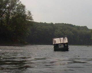
The above photo was sent by Leona Fluck. The Waste Management dumpster got stuck on a gravel bar somewhere near Minisink Island (Leona correct me if i got that wrong) in the Delaware Water Gap National Recreation Area. Photo was taken during a routine patrol of the National Canoe Safety Patrol - Lower Delaware Chapter. The NCSP is a vital partner for the river cleanup 'Operation River Bright' scheduled for September 16 and 23. The National Park Service is making plans to move the dumpster before Ernesto sends it down to Trenton.

Wait and see...

Forecasters are singing in unison about Ernesto's path through our region enroute to the wilds of upstate PA and western NY (Susquehanna Basin). Rainfall predictions seem to be in sync, most caution that "rainfall amounts could be higher in certain areas."

AccuWeather's map shows the entire non-tidal Delaware River watershed to be within the 2 - 4 inch range; below Philly it says 6 to 8 inches. The Catskill headwaters might get 1 - 3 inches.

If that scenario holds -- more rain to the south and less to the northeast -- we will probably avoid major flooding. The water level in most Delaware River tribs has been falling. In the lower Delaware tribs are still faily low. I wouldn't even ty to put a canoe in the Musconetcong (1.67 at Bloomsbury), ditto for the Pequest, and the Paulinskill is barely high enough to paddle). On the PA side the Tohickon is seasonally low.

Further upstream the Lehigh River has been running a higher than normal, largely because the Army Corps has been releasing from FE Walter dam (a flood control reservoir). PP&L has been letting water out at Lake Wallenpaupack (and making $ on electricity generated) to make room for the storm. Pocono streams (Brodhead and Bush Kill) are running a little high for this time of year.

I don't see the Delaware River flooding unless we get double the amount of rain predicted (8+ inches) over most of the upper watershed. Tribs are more vulnerable as the rain will be coming down in a short period of time. The predicted outcome could be so much worse - let's hope and pray it holds, or better yet, that Ernesto falls well short of its reputation.

For those of you who (like yours truly) are compelled to check stream flows on a regular basis, the Mohawk Canoe Club has a handy one-stop page of river gauges for paddlers. It includes many streams outside the Delaware River Basin. Check it out. The Mohawkers are another important partner on the river cleanup, which by the way is sponsored by the Delaware River Greenway Partnership. Check out their website, lots of good information on Lower Delaware River projects.

We may be working up a contingency plan for Operation River Bright because high water would make a river cleanup unsafe. For now it's wait and see what happens over the next 24 hours and assess the long range forecasts.

I will be back tomorrow with an update on river conditions around the watershed.

Thursday, August 31, 2006

Weekend flash flood watch...

The Philly Inquirer has an interesting article about storm forecasting. Forecasters are supposedly better at predicting storm track than storm intensity.

Speaking of which, Ernesto is predicted to weaken to an "extratropical low." That means not a lot of wind but potentially a lot of rain. Wunderground says the following:

"The track reasoning remains unchanged from the previous advisory. Ernesto is forecast to continue north to north-northeastward between a deep-layer ridge over the western Atlantic and a deep-layer trough over the eastern United States. As Ernesto becomes extratropical it is expected to turn slightly north-northwestward around the east side of a cut-off low over the Ohio Valley. The official track forecast remains virtually unchanged and is an update of the previous advisory."

National Weather Service continues to say:

WIDESPREAD RAINFALL TOTALS OF 3 TO 6 INCHES ARE EXPECTED WITH LOCALIZED TOTALS UP TO 10 INCHES POSSIBLE.

Unfortunate;y, as of 7:00 AM this morning the USGS stream gauges are down (at least for NJ and PA).

Hopefully we'll get one day of sunshine.

Wednesday, August 30, 2006

Deja vu all over again...

Every conscious person living along a stream or river in our region, especially in the piedmont and mountain regions has to be thinking 'Oh no, not again!'

No one knows what is in store, that's for sure. But the circumstances surrounding Ernesto are similar to conditions that led up to the last flood. Significant rainfall followed by heavy rainfall. The situation right now is not nearly as perilous as last June, when the river was already running quite high and reservoirs were full.

Over the past few days some areas have had soaking rains, but most of these are lower lower basin watersheds (Chester, Montgomery, Camden, Gloucester). Upper Delaware tribs were moderately high and are already starting to go down. NOW IS THE TIME TO BEGIN LOWERING RESERVOIRS!

The Delaware River at Calicoon is going back down, but the river at Riegelsville is still coming up, althoug I think that gauge should top off at 6.0' sometime tonight (flood stage is 22'). I believe we will need all of 8 inches of rain to get the Delaware River out of its banks again. Tributaries are much more vulnerable.

AccuWeather is predicting that Ernesto will dump "more than 6 inches" of rain as it slowly moves from North Carolina up through Pennsylvania.

Wunderground predicts 4 to 8 inches.

The National Weather Service in Mt. Holly says the storm is more likely to aim for South Central PA, which would still produce heavy rain here; they are holding off on numerical predictions. But NWS holds out some hope for the other model that has Ernesto spinning to the east and off the coast, a scenario that would only produce moderate precipitation here.

The picture will become more clear late tomorrow once it is know just where Ernesto make its second landfall (Outer Banks again?), something that is relatively rare. Katrina made two landfalls!

Tuesday, August 29, 2006

Not a promising scenario...

The lower Delaware River Basin (below Trenton and Schuylkill watersheds) has received extremely heavy rain. The upper and middle Delaware River watersheds have not received more than a few inches over the past 24 hours, at least so far. A few streams are running moderately high such as the Brodhead and Bushkill. NJ tribs are not running high at all so far.

What is most disturbing is Ernesto is pretty much universally predicted to run right up into Pennsylvania. It's a big state so if we're lucky it will head west. Indeed, one model has Ernesto heading for Ohio.

Alas, most models show the tropical depression heading for us, and South Jersey and SE PA could get as much as 9 inches before it passes through Saturday evening, with the upper watersheds getting less. We might have a few nice days before the storm reaches us, giving streams some time to go back down, and for the ground to absorb what has already fallen.

Either way, it looks like an unhappy weekend is in store for those who like to play in the sun. Another lesser concern is the impact that this wet weather will have on river levels going into September when Operation River Bright is scheduled to take place. We need the river to be less than 4.50 at Riegelsville to safely do a cleanup of river banks. Contingency plans are now under development.

AccuWeather lays out the complex set of factors that will control the path and intensity of Ernesto.

Will Ernesto Deluge The Northeast?
Updated: Tuesday, August 29, 2006 7:51 AM
For those more scientifically inclined, here is the setup. Tropical Storm Ernesto will be influenced by several factors this week. Probably the most important is land. There is too much of it in the way. That's bad for tropical storms, but great for people. As long as Ernesto stays away from wide open water, there is a limit to how strong the storm can become. On the other hand, there is bath water laying in wait off the Southeast coast, and the storm will be over that on Thursday when it has a chance to become a Category 1 hurricane. Something that will play a huge factor in the future of the storm is the jet stream. It will change shape considerably over the next 48 hours, becoming much more south to north. This will latch onto Ernesto and bring the storm right up. The flow may back so much that in time the storm could actually turn toward the northwest. The final player will be high pressure building to the north. The high will slow the storm's forward progress, while at the same time help to intensify the wind along the central Atlantic coast.
Story by AccuWeather.com Expert Senior Meteorologist John Kocet.

Hurricane Watching...

These days I am using three sources to keep track of significant weather events. AccuWeather, Weather Channel (NWS), and Wunderground. All rely on NOAA-NWS data gathered by various sources including satellite and storm tracking planes. What happens to the data is critical as there are different models being used to predict weather with varying results. For those situated in a floodplain it is advisable to pay attention to all the forecasts and prepare for the worst.

ERNESTO appears to be headed to our region this weekend as a tropical storm.

Here is a quote from Wunderground as of 5 AM this morning: "The models also agree that Ernesto should re-emerge over the Atlantic off the northeastern Florida coast and make a second landfall in the South Carolina-North Carolina area in 60-72 hours. After the second U.S. Landfall...Ernesto is expected to be caught up by the aforementioned shortwave trough and be drawn northward into the eastern Great Lakes area and possibly become a significant extratropical low pressure system. The official forecast track is just an extension of the previous track through 72 hours...and then west of the previous track at 96 and 120 hours.
This is consistent with the various NHC consensus model forecasts."

AccuWeather gives a slightly different twist with both a more hopeful and a more dire scenario: "
Flooding concerns could return to the Northeast this Labor Day weekend if a trough of low pressure, currently over the country's midsection, stalls and then lingers over the Mississippi Valley. AccuWeather.com is hoping that the trough will continue to shift eastward and send Ernesto out to sea; however, if the trough lingers, then the southerly winds around the trough will guide the storm northward into the mid-Atlantic states and Northeast region on Friday and into the Labor Day holiday weekend. If Ernesto does take a northerly track, flooding rain could deluge areas that were ravaged by floods at the end of June.
AccuWeather.com is also monitoring the possibility that the trough does shift Ernesto past the North Carolina coast, but a blocking area of high pressure would then stop any more forward progress. With the high firmly in place to the northeast of the storm, Ernesto would just sit and spin off the North Carolina coast, possibly moving back inland after a few days."
(Story by AccuWeather.com Meteorologist Kristina Baker)

Meanwhile, the Delaware River at Riegelsville is up almost a foot to 4.29 and the tribs have come up a bit. Once again the Pocono Region streams have received the most rainfall and are the having the greatest impact on the river. There is a flood watch in effect today for streams in the region, but this poses no threat to the river. We need to dry out before Ernesto gets here. There is hope that Ernesto will just GO AWAY (head out into the Atlantic), but that appears to be the least likely scenario.

I will update the hurricane watch as needed.

Sunday, August 27, 2006

Oh no...much needed rain but...

This just in from Wonderground!

"... Potential for severe thunderstorms today and very heavy rain over the next three days...

Showers and thunderstorms were scattered across the area this morning... but later today... some may be accompanied by damagingwinds... hail and very heavy rainfall. A cold front that passed to our south will return today as a warm front. The air ahead of it will be stable... but behind it increasingly unstable. Showers and thunderstorms are expected to form along the boundary and develop into some very strong storms. Damaging winds... hail... torrential
rains and even the possibility of a tornado could very well happen this afternoon and evening.

Please stay tuned for additional forecasts and listen in the event a severe thunderstorm or Tornado Watch is issued later today. Once a watch is issued... it is just a matter of watching the Doppler radar for storm development and issuing appropriate County
warnings.

Over the next couple of days the dry conditions that have existed for much of August will be replaced by torrential downpours. Although a general two inch rain amount could occur over a wide area... there may be some isolated locations that receive four to five inches as thunderstorms move over the same spot. It has been so dry of late that it will take about three inches in one hour to cause flooding on some larger streams... but less is needed on the smaller streams that can turn into a flash flood in a hurry.

Once again... stay tuned for additional information."

Oh, you can count on that.

Friday, August 18, 2006

Operation River Bright...trash talk


Volunteer for Operation River Bright
September 16 & 23


Much has been written about the floods that have plagued the Delaware River and its floodplain communities. The untold story about the floods is the enormous amount of trash, litter and debris that was left behind by the receding floodwaters. This unsightly plague of plastic, styrofoam and metal is a threat to the river and ultimately to the bay.

During a normal year, back in the day not so long ago when floods weren't the norm, most trash that ended up in the river came from three primary sources: inflow of litter that reaches tributary streams via urban and/or highway drainage systems; shoreline fishermen; and illegal dumping (tires, appliances, construction materials).

The floods have added an entirely new source of trash. Each of the last three floods has swept away the entire contents of homes, cottages, sheds, and backyards. In some cases entire cottages, sheds, portapotties and camping trailers were carried away and deposited on the river banks and islands. The floating docks built along riverfront communities like Carpentersville and Byram were also blown apart and scattered around the river. Floating docks are the source of all the blue barrels that dot the river banks.

The trash is dispersed along the entire length of the river, but clearly the lower Delaware River below the Water Gap, and especially below the Lehigh River is much more trashed than the upper and middle sections. The reason for that is there are more people, homes, drainage ditches, fastfood restaurants, malls, and highways. Paddling downriver from Smithfield Beach or Worthington State Park you will see very little in the way of ugly trash. But rounding the bend above the Water Gap at Interstate 80 and the confluence of Brodhead Creek, trash appears everywhere along the river banks, nestled within the Japanese Knotweed and nettles.

In some cases the trash blends in with trees, branches, twigs and other natural debris to form glacial piles of trash. These tend to occur on the outside bends of islands and at the upper ends of islands. Trash also accumulates in floating mats of flotsam that usually find a resting place in the smaller eddies that can be found along the edge of the river.

I look at the glacial piles of trash on Hendricks or Lynn Island and wonder what these would have looked like after the record flood of 1955. The answer is: PLASTIC. It simply would not have been there in '55.

The most ubiquitous and ugly type of human trash is plastic. Plastic bottles, silt fences, food-store bags, and the occasional Mr. Turtle Pool. Back in 1955 one might have found some glass bottles mixed in the flotsam and jetsam piles, but probably not very many since bottles were returnable back then. But hey, what do I know? I was only five in '55.

The most recent flood carried away portions of the glacial trash piles, and built a few new ones. The piles that were carried away made it to the tidal river, and I saw evidence of this while visiting the Riverkeeper boat at the D&S Marina in Tullytown. All the boats were surrounded by floating mats of trash, mostly plastic. I expect the Delaware Bay beaches will have a new influx of trash that may have originated as far away as Walnutport on the Lehigh River, or Lake Wallenpaupack on the Lackawaxen River. No doubt the trash does not go away, and it does migrate downstream.

This year we will attack the ugly trash that plagues the lower Delaware River. The emphasis of the 2006 Operation River Bright will be to attack this plague of plastic and remove it from the river and its surrounding environs.

ORB mostly needs canoes to do the job, but we also welcome kayakers and a few power boats would make the job easier too. Email me to sign up for Operation River Bright.

More details about ORB will appear in a forthcoming post to this blog.