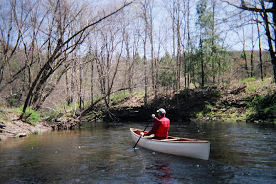
Thursday, April 26, 2007

OPERATION RIVER BRIGHT...


VOLUNTEERS NEEDED FOR OPERATION RIVER BRIGHT
Volunteer boaters are needed on Saturday, June 9 to help remove litter from the river accesses, shorelines and islands along targeted sections of the Lower Delaware River between Easton-Phillipsburg and Riegelsville. Sign-in and shuttle begins at 8:00 AM and the cleanup will last until approximately 2 PM. Pre-registration is required (see below).

Operation River Bright offers a wonderful opportunity for recreational paddlers, fishermen, local residents, and organizations to give something back to the river by helping clean-up unsightly trash and debris, much of it left by the recent floodwaters.

To register and/or learn more about River Bright simply respond to this email. When registering please indicate what kind of boat you will be using. Further details about meeting time and place, shuttle arrangements and other details will be provided to registered volunteers.

The greatest need is for paddlers with canoes, but kayakers are also welcome. All paddlers will be required to wear a PFD while underway. We are also seeking a few powerboats and boaters to help out.

Operation River Bright is an American Canoe Association (americancanoe.org) sanctioned event, which means that we always follow their safety guidelines at all times. In the interest of safety and liability concerns we have found it is preferable to conduct river cleanups with people who have some degree of experience paddling on the river (with as many experienced paddlers as possible in the mix). In addition to a safer and more enjoyable experience, we accomplish more! In that regard I will once again offer a training day for the NJ Youth Corps members, who have been wonderful partners with Operation River Bright over the past several years.

Delaware River Greenway Partnership began sponsoring river cleanups in 1998 and continues to serve as the main event organizer. Other event participants and/or sponsors will include the New Jersey Youth Corps of Phillipsburg, American Rivers, National Canoe Safety Patrol - Lower Delaware Chapter, Mohawk Canoe Club, Lazy River Outpost, National Park Service, and the Lower Delaware Wild & Scenic River Management Committee. We will be adding more organization sponsors in the coming weeks.

I have paddled the river several times this past winter and with the leaves down it was even more evident that there is an enormous amount of trash on its islands and banks. One of the worst areas that can be found along the 200-mile non-tidal river is the 10-mile stretch between Easton-Phillipsburg and Riegelsville. It will take a sustained effort over the next few years to put a dent in the volume of the trash that blights the Lower Delaware National Wild and Scenic River. Won’t you please give something back to the river and help Operation River Bright end this river blight?

Let me know if you can help.

Sunday, April 22, 2007

Running the Musconetcong River...


And running we were on Friday, April 20 with the Musky a brisk 3.62' which is well over what we are used to doing. Last trip was 2.10' and while that might not sound like much of a difference, on a small creek or river it is a big difference.

We did the 8-mile stretch between Penwell Dam and Hampton Borough Park in about 2 hours, considerably less time than usual.

Eric Sween, Wally Jenness and Chris Meyers made up the river running party on this sweet spring day. There were no fishermen (this is a major trout stocked river) until the last mile at the Pony Truss Bridge at New Hampton, and Hampton Borough Park. They were lined up and stood in surly silence as we rocked and slashed through some nice waves. I was grateful not to fall in for the boys coming though the breached Imlaydale dam, where the three canoeists among the group all took on some water. Eric, in a Dagger Creek boat (kayak) had a skirt and was dry (from the waist down).

No mishaps and a swell day on the river.

Breaking news: NJDEP is proposing that the Musconetcong River be upgraded to a Category One designation. More on this as the story develops.

Tuesday, April 17, 2007

Rivers fall...

Out with the old, in with the new... trash. A Delaware River cleanup is planned for Saturday, June 9. Details forthcoming, or email me to get on the list.

The Delaware River at Riegelsville gage is finally flatlining at 21.37' which is several inches below the 22' flood stage for that gage; a little too close for comfort.

None of the other flood prone locations have flooded along the river, save for a few low-lying spots on river road on the PA side (Rt. 32). The Delaware River at Belvidere gage, which is upstream from the Lehigh River confluence, fell over 5' short of flood stage. At the Montague gage (30 miles above the Water Gap) the river fell about 7' short of flood stage.

Hmmm....the river came close to flooding at Riegelsville and New Hope, but didn't come close to flooding at locations further upriver in the direction of the...NYC reservoirs. Interesting.

Will the river rats... Blame it on the bossa nova?

Here's to a streak of sunny days and warm temps!

Monday, April 16, 2007

River report...

Bucks County Playhouse as seen from the parking lot at Lambertville Station on Monday, 5:30 PM. The New Hope gage is reading 10.63 this evening, and flood stage is 13.0'.
One can hope.


Looks like the river at Riegelsville will come close to leaving its banks, maybe even go over at 22.0' if it continues to rise. The Belvidere gage however is several feet from flood stage (also 22.0') and doesn't appear that it will come close at all (currently 15.85').

Port Jervis is another place that won't reach flood stage (currently 11.10').

Trenton is also predicted to have minor flooding.

What does this mean?

It doesn't appear that the upper Delaware River will be flooding, and the lower section of the non-tidal river may flood in two or three locations below Easton (the Lehigh confluence).

We'll take a look tomorrow.

River Rising...

Checking the USGS gages up and downriver and fortunately many tributaries, but not all, have crested and begun to fall. The big rivers are all still rising however and that is not good. The precip has tapered off somewhat and is now ice and snow, that will slow the runoff factor.

The Delaware River at Riegelsville is at 16.26' as of 8:56 AM, about 6 feet below flood stage, and still rising. It won't likely crest until tomorrow morning so there may be some minor flooding as it is predicted to crest at 22.05'. The river at Belvidere is around 12.09' and rising, with flood stage at 22.0'.

Notables tribs are Musconetcong River, which rose to about 6.70' (6.0 is flood stage) and has fallen. The Lackawaxen River is just beginning to flatline at 8.96' and the Brodhead Creek is on the way down from 8.25, well short of flood stage at Minisink Hills gage.

The all important Lehigh River, which exerts the greatest influence for those living downstream of the Forks of the Delaware in Easton, is still rising and currently 7.70, but well short of flood stage. However it is enough to exacerbate the situation on the Lower Delaware. The Flat Brook at Flatbrookville is still rising at 9.05' well above the 6.0' flood stage. Good news is there are virtually no homes along that wilderness creek.

The Locatong Creek and is now at 7.84 having been as high as 9.10', over flood stage. The Wickecheoke Creek has also fallen from over 9.0' to 5.32'. Both of these shaly streams go up and down like a yoyo.

Sunday, April 15, 2007

Stream level update...

The Delaware River at Riegelsville has surged three feet so far today and is now over 9.00' and Flood Stage for this location is 22.0'. The river at Belvidere has only risen about 1.00' and that is ablove the Lehigh River confluence.

This tells me that the lower non-tidal Delaware River tribs from the Lehigh River and downstream are experiencing the highest levels and that can be seen in the Musconetcong River, which has come up a remarkable three feet so far today and is now closing in on 5.50'. Flood stage is 6.0'. A three foot rise on a small river like the Musky is big.

Not to be outdone, the Wickecheoke Creek at Stockton has risen a shocking 6.0' today and is now clsoing in on 8.40'. The Wicky is just up the road and I will be heading out to look at it shortly. Across the Delaware the Tohickon Creek has also risen 3.0' and is still surging. This is well below the Riegelsville gage and impacts the river below Frenchtown NJ.

The Delaware River will definitely come up into the mid-teens before it is over, but the rain appears to be slowing a bit and hopefully it the river will crest sometime tomorrow morning.

MAKING OF A MYTH: the Reservoirs Did It!

The sign was supposed to read "Local Stream Ecology" but some creative person rearranged it and I just happened to catch it with the camera. It was my first and only speaking engagement in a church, back in 1989. Well, maybe church is a stretch given the denomination. Locals do ream ecology however, and many who don't know the difference between a headwater and a tailwater are promoting a specious narrative about how the last three floods came about.


That's the title of a future blog and it is a reaction the growing hysteria that has overcome so many self-decribed "river rats." Trouble is, unlike rats, which are fairly smart creatures, people whose ability to think is impaired by their anger and fear are most decidedly not smart, especially when these particular emotions are spawned by profound ignorance.

Here is an example of the not-so-smart reasoning from a "river rat" whose only apparent credentials are having lived along the Delaware River in New Hope for twenty years.

In making the case that the past three floods would have not occured except for mismanagement of the three NYC reservoirs located in the Catskill headwaters, this "river rat" points to Hurricane Floyd, when the reservoirs were below 80% capacity, and the river did not flood. Problem with this logic is this: Floyd visited in the midst of a prolonged drought, and the pounding tropical storm fell on parched land that absorbed much of the storm's wicked punch. The heaviest bands of rain fell in the lower watershed, specifically between the Water Gap and Milford NJ/UBE. Many tributaries flooded, but the Delaware stayed within its banks. The reservoirs were not full precisely because we were into a serious drought, the land was dryed out, water table low etc.

Floyd is but one phony example that the "river rats" are using to make the specious case that all their flooding woes are the result of reservoir mismanagement; as if what happens in 10% of the entire drainage basin completely controls what happens downstream. The architects of the MYTH are holding a public mass hysteria meeting this week at the New Hope firehouse and the local media will cover it to be sure.

The MYTH already has taken hold so deeply that it's doubtful that any amount of reason will root it out. After all, wouldn't it be so comforting to believe that the floods are the result of human error and incompetence? That would imply that the flooding could be prevented simply by changing policy. Keep the reservoirs at 75% and we''ll all be high and dry, happily inhabiting our floodplains without a worry.

What is the alternative? To believe that the floods are a random act of nature? An act of God?

Well guess what? Floodplains flood. Keep the reservoirs at 60% and flooding will still occur in this river's floodplain. People who live on it do so completely at the mercy of nature. Manmade influences (reservoirs and development) do count, but not anywhere remotely close to the degree people would like to believe, or have been led to believe.

Well that's my rant for today and maybe the week. I will be writing more comprehensively about this topic soon...any day now. So much BS to clean up.

Meanwhile, it's raining cats and dogs and the river is rising and the reservoirs are full!

-- "He who hears the rippling of rivers in these degenerate days will not utterly despair."
Henry David Thoreau

Monday, April 09, 2007

Hydrologic conditions...


The above pic was shot on the Flat Brook last May. It is one of New Jersey's most undeveloped and scenic streams, and flows into the Delaware River at Walpack Bend, my favorite camping place on the Delaware River. Like most of the streams and rivers in the region the Flat Brook is currently running slightly lower than normal.

T
he National Weather Service maintains an excellent web based resource known as "Hydrology - River, Rainfall, Snow and Ice Data."

This is the essential tool for keeping up with everything having to do with rivers, and the weather and other factors that influence floods, droughts and other calamities.

The last installment of the
WINTER/SPRING FLOOD OUTLOOK #8 has been posted for the region including the lower Delaware River Basin and Raritan Basin. River information can be found under "Guidance : Forecasts and Statements."

The potential for flooding is "slightly above normal" for this time of year. If we receive moderate rainfall the desired effect will be lower soil mositure, lower flows, and lowered flood storage in the reservoirs. One can only hope. There aren't any big storms on the horizon, at least for this week.

Right now the Delaware River is running just under 7 ft. at Riegelsville, which is near normal level for April. The Musconetcong is running slightly below normal as are most of the other NJ tributary creeks and rivers. Ditto for the major PA tribs, such as the Lehigh and Lackawaxen rivers and Brodhead Creek...

The Delaware River Basin Commission River Recreational Maps are now in stock!!! These are updated and have been out of stock for some time. They are not free, but worth every penny for any boater who wants serious detail about where the rapids and rocks can be found. These 10-section, waterproofed maps cover the river's east and west branches prior to their confluence at Hancock, New York, the entire 200 mile, non-tidal reach of the river from Hancock to Trenton, New Jersey, and an additional 25 miles of the tidal river from Trenton to just south of the Betsy Ross Bridge (connects Northeast Philadelphia, Pa. and Pennsauken, N.J.).etc.

The River Rec maps were revised by the Delaware River Water Trail Committee, which I worked with up until my departure as executive director for the Delaware River Greenway Partnership.

The Delaware River Water Trail will have its official kickoff ceremony at Washington Crossing Park, PA on Friday April 20. Details forthcoming, but contact me if you would like to attend.

Monday, April 02, 2007

Running the Musconetcong River...


Christopher Myers shoots a fishing weir during the Outdoor Club of South Jersey's first Musconetcong trip.

Enjoyed the honor of leading the Outdoor Club of South Jersey on an 8-mile run down the Musconetcong between Hampton Borough and Bloomsbury (Rt. 173 Bridge). To view the OCSJ photo gallery just click on the above link and go to the canoe section phto gallery.

I've gotten a bit fussy about how low I am willing to go in terms of water level. But despite the misgivings it was a pleasant trip with only one or two rock kissing moments, and that was at a paltry 2.10' at the Bloomsbury gage. And of course it helped to have someone else's canoe (George and Leona's Blue Hole), since the Howler is getting very thin underneath, and thus my aversion to scratchy creeks and rivers.

We has a total of ten boats (7 kayaks and 3 canoes), and most of the group had never paddled the Musconetcong, which made it a bit more fun since I enjoy answering questions and dispensing unsolicited trivia about the river. But then again I wrote the book -- literally.

It was a nice group and they really got a taste of just how fine this river truly is -- a National Wild & Scenic River at that. Water clarity was great and we observed several blue heron, common merganser, wood duck, black duck and various newly arrived song birds, especially the king bird, a bug-eating river loving resident of the flood plain forest.

The Hampton to Bloomsbury run is the best river segment to run during low flow as it tends to be narrower and deeper. Above Hampton a 2.25' and higher is really preferred, and above Hackettstown 2.50' as low as one wants to run the boulder field in Stevens State Park.