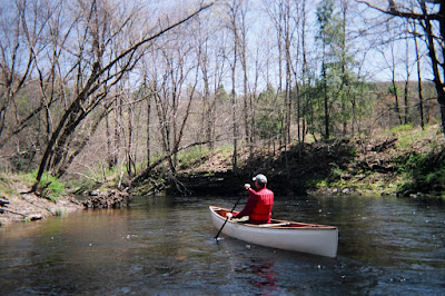
The above pic was shot on the Flat Brook last May. It is one of New Jersey's most undeveloped and scenic streams, and flows into the Delaware River at Walpack Bend, my favorite camping place on the Delaware River. Like most of the streams and rivers in the region the Flat Brook is currently running slightly lower than normal.
The National Weather Service maintains an excellent web based resource known as "Hydrology - River, Rainfall, Snow and Ice Data."
This is the essential tool for keeping up with everything having to do with rivers, and the weather and other factors that influence floods, droughts and other calamities.
The last installment of the WINTER/SPRING FLOOD OUTLOOK #8 has been posted for the region including the lower Delaware River Basin and Raritan Basin. River information can be found under "Guidance : Forecasts and Statements."
The potential for flooding is "slightly above normal" for this time of year. If we receive moderate rainfall the desired effect will be lower soil mositure, lower flows, and lowered flood storage in the reservoirs. One can only hope. There aren't any big storms on the horizon, at least for this week.
Right now the Delaware River is running just under 7 ft. at Riegelsville, which is near normal level for April. The Musconetcong is running slightly below normal as are most of the other NJ tributary creeks and rivers. Ditto for the major PA tribs, such as the Lehigh and Lackawaxen rivers and Brodhead Creek...
The Delaware River Basin Commission River Recreational Maps are now in stock!!! These are updated and have been out of stock for some time. They are not free, but worth every penny for any boater who wants serious detail about where the rapids and rocks can be found. These 10-section, waterproofed maps cover the river's east and west branches prior to their confluence at Hancock, New York, the entire 200 mile, non-tidal reach of the river from Hancock to Trenton, New Jersey, and an additional 25 miles of the tidal river from Trenton to just south of the Betsy Ross Bridge (connects Northeast Philadelphia, Pa. and Pennsauken, N.J.).etc.
The River Rec maps were revised by the Delaware River Water Trail Committee, which I worked with up until my departure as executive director for the Delaware River Greenway Partnership.
The Delaware River Water Trail will have its official kickoff ceremony at Washington Crossing Park, PA on Friday April 20. Details forthcoming, but contact me if you would like to attend.


No comments:
Post a Comment