Wednesday, July 26, 2006

Almost Heaven.....


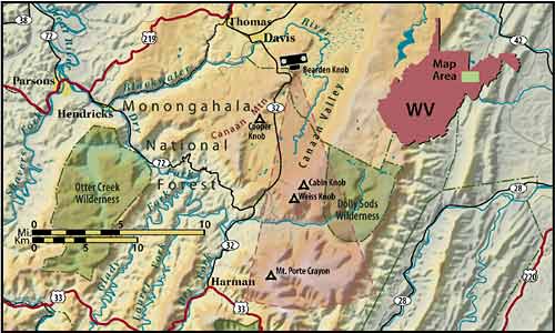
The highest mountains of Monongahelia National Forest in West Virginia is where I am headed for the umteenth Parsons Family Reunion (mom's side). Checking back in on August 1st.

Monday, July 24, 2006

Huge Victory for the Musconetcong?


Musconetcong to be National Wild and Scenic River


CURRENT HOUSE FLOOR PROCEEDINGS
LEGISLATIVE DAY OF JULY 24, 2006
109TH CONGRESS - SECOND SESSION
2:36 P.M. -

Mr. Walden (OR) moved to suspend the rules and pass the bill, as amended.
H.R. 1307 to amend the Wild and Scenic Rivers Act to designate portions of the Musconetcong River in the State of New Jersey as a component of the National Wild and Scenic Rivers System. Motion to reconsider laid on the table Agreed to without objection. On motion to suspend the rules and pass the bill, as amended Agreed to by voice vote.

Mein Godt!

I simply can't resist the temptation to count the chickens before the eggs hatch, but it looks like the Musky will be included in the nation's Hall of Fame for rivers, based on it's "Outstandingly Remarkable" natural and cultural features.

All that is needed at this point is the signature of the leader of the free world who recently revealed his aptitude for foreigh policy by saying, "Russia is big and so is China." Hopefully President Bush will do the right thing and sign the Musky designation legislation into law.

The effort began in early 1990's when former Warren County Freeholder Susan Dickey and members of the Musconetcong Watershed Association began circulating a petition for a Wild and Scenic Rivers eligibility study. In 1996 the National Park Service agreed to conduct such a study and provided funding for same. That became my primary task when I came to work for the MWA, serving as its executive director until 2003.

A stellar cast of volunteers from Hopatcong to Pohatcong gathered an impressive amount of supporting evidence that the Musky is indeed one of the most outstanding remarkable rivers in not only New Jersey, but the entire region. All but one of 26 municipalities within the watershed supported the study and designation. That one exception, Pohatcong Township has also never supported the Lower Delaware designation (unfortunately, it sits at the confluence of the two rivers). The town leaders simply could not grasp the concept of the Partnership Rivers program, which is tailored to rivers that flow through primarily private lands. The NPS does not have any regulatory authority over land use decisions - the existing system of local, county and state government remains exactly the same. Similarly, the NPS has no regulatory authority over boating and fishing, which remains with the state agencies, in this case NJDEP Division of Fish and Wildlife.

What the designation will bring is funding from NPS (which must be matched) to carry out goals of the management plan. One such goal is removal of obsolete lowhead dams, an effort that is already underway. Another benefit is that the NPS must review any project that requires federal permits or involves fed funding, such as dam construction.

And, since the NJDEP has completely dropped the ball on watershed management, the Musky W&S designation provides for the continuation of a river management committee that looks at the big picture beyond municipal and county borders. Other benefits to the river and its historic communities will also come with the National Wild and Scenic designation. Details to follow.

Congratulations to the Musconetcong Watershed Association and all those people who care about one of our nation's great waterways!
A Week Well Spent


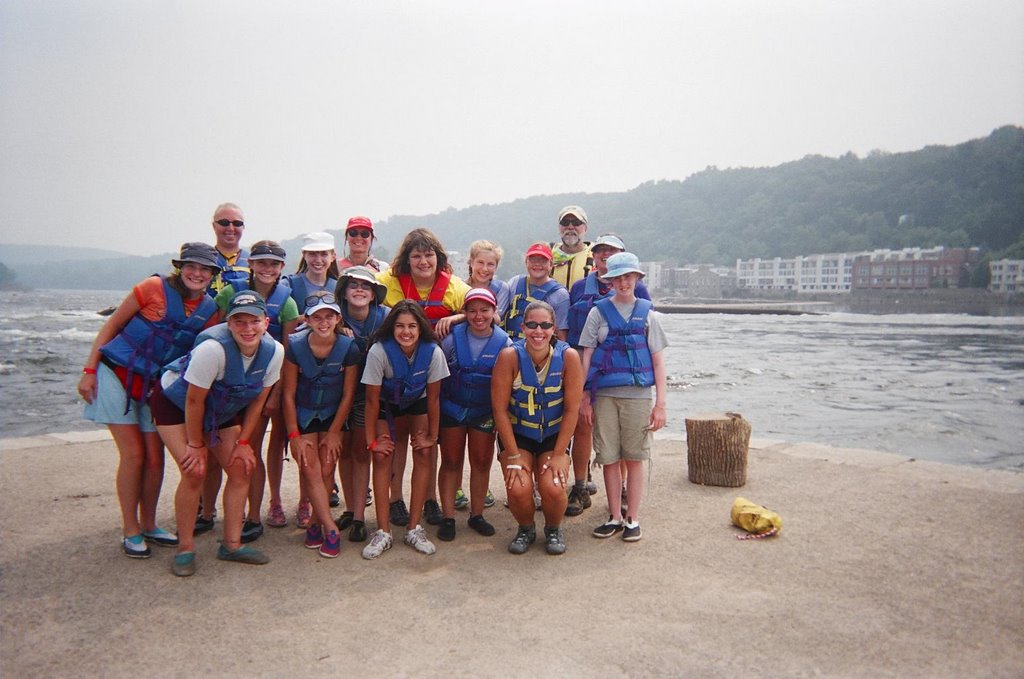
A week on the river is guaranteed to be a great experience, even if it involves guiding between 15 and 18 Girl Scouts (depending on the day's attendance) on a 35-mile sojourn during the first blistering heat wave of '06.

The 2006 Rhythms of the River Sojourn with scouts from Camp DeWitt (Rolling Hills Council of GSA) was indeed a great experience for all. These kids learned the basic tandem canoe strokes and combinations thereof. They learned not to fear but to respect the power of the river. They learned about self-rescue. They observed the flood damage, wildlife, scenic views, geological features, and historic structures. They will never look at any river the same way again.

Some of the more notable wildlife sightings included: Eastern Brown Water Snake (they were shocked), Kingfisher, Osprey (diving successfully for a fish), Caddisfly larvae (what are those green worms on our feet?), Great Blue Heron (many many sightings), Cattle Egret, Turtles, and Vultures.

Two Bald eagles greeted us at Lynn Island. I have observed a solitary Eagle at this location several times (as have a few other fellow river ratz) this summer. Now there are two. We may have a nesting pair in 2007, somewhere between the Nockamixon Cliffs and Traugers Farm Market.

Many thanks to lead canoe instructor and Sojourn Partner Linda Straus (especially for maintaining your ACA Instructor certification), Hank and Bunny Snyder of Lazy River Outpost in Phillipsburg for providing trasportation and equipment, Dee Keller of Kellers Landing for providing an outstanding river access and teaching environment for days 2 & 3, and Alicia Hanson of Camp DeWitt for helping iron out all the details.

This blog will return to the issue of Delaware River floods upon my return from Pittsburgh and the high mountains of the Monongahela National Forest in northern West Virginia. For a real-time view of this gorgeous region go here. If time allows and we actually have a wireless connection in Canaan Valley National Wildlife Refuge, I may offer up a few short posts about the Cheat River watershed.

Friday, July 21, 2006

That kind of summer...

I remember 1984 well. Not in an Orwellian sense, but that particular July was similar to what we are experiencing this summer. July 7, 1984 turned out to be the date of the 6th place record flood on the Perkiomen Creek (largest trib to the Schuylkill River). Recurring heavy summer storms over a period of two (or 3?) weeks culminated in a 4-inch-in-1-hour event that sent the Perky way out of its banks. I lived in a log cabin that was situated in the floodway. Ended up tethering the Datsun station wagon to the big ash tree. The front porch became Noah's Ark. That is a story that will be told in full sometime soon.

Meanwhile, the Tohickon Creek, shaly piedmont crick that it is, shot up from 1.48. to 2.81' over the last few hours, harbinger of things to come for more pervious watersheds. We are getting heavy rain in the lower Delaware River watershed. Looks like the Pocono region is not getting all that much right now, but that will probably change.

If the forecast is correct the larger rivers will probably not exceed flood stage, however tributaries are likely to go out of their banks.

All eyes on the NWS and flood forecasting folks.

Week on the river winds down...

Fourteen Girl Scout Cadets from Camp DeWitt are now fairly accomplished tandem canoeists. Anyone who has learned the art of tandem paddling knows that is no small feat.

Marriages have landed on the rocks from the bickering and acrimonious blame-casting that can occur when the tandem canoe hits the rocks. Usually the male part of the duo, who is invariably paddling stern will try to deflect blame when the boat goes in the wrong direction.

Our group of scouts can now perform all the basic canoe strokes plus a few that most never learn, such as the cross-dufek and low-bracing sweep.

Today we finish up with a run from Byram to Lambertville and today we will fiocus more on self-rescue, which involves in the water exercises. We will also try to outrun the predicted storms.

Next post will feature a few photos from the Camp DeWitt - Rhythms of the River Sojourn.

Then it's back to looking at the many issues surrounding the June flood, including a report on the DRBC hearing which I missed this week.

Monday, July 17, 2006

100 Degrees

That's what they predict for today.

Journal entries will be sparse for the next 2 weeks, have a 5-day canoe trip with 15 Girl Scouts from Camp DeWitt beginning this morning, leaving the weekend to catch up on the blog. Next week its off to Pittsburg and then Canaan Valley, West Virginia for the Parsons Family reunion.

Keep cool.

Saturday, July 15, 2006

A Few noteworthy river trips...


I have kept a River Journal since 1992 when I came to Lambertville to work for Delaware Riverkeeper Network. Journal entries are short and cover basics such as the river segment paddled, mileage, wildlife, weather, river conditions and paddling companions. I have since logged about 2,800 miles canoeing creeks and rivers, almost all in the Delaware River watershed, with occasional forays to places like Assateague, MD, West Virginia (Cheat River), Pine Barrens, Susquehanna River, and Raritan River. Almost all the paddling is on local waterways.

So far this month I have done two noteworthy river trips. The first was last Friday (7-07) when Sherry and I accompanied Fred Stine and his son Chris (pictured above) who were on a mission to shuttle the Delaware Riverkeeper's motorboat from D&S Marina in Tullytown downriver to Penns Landing, just below Ben Franklin Bridge. The trip began in the shadow of the massive Waste Management Landfill. The marina had problems with floating piles of flotsam and trash that came down the river during the June flood. Plastic bottles, tree trunks and other floatables were swept down the non-tidal river from places like Delaware Water Gap, Easton, Belvidere, Lambertville. Much of that ends up in the tidal Delaware River, and on the Delaware Bay beaches.

From the marina we entered the main channel in the "Riverkeeper" and were treated to a 20-mile long panorama of the tidewater towns and shoreline until the Center City skyline came into view. It is such a different world from the familiar upland Delaware River that I have come to know so well. Bristol PA and Burlington NJ in particular had attractive riverfronts. The NJ shoreline in places was surprisingly natural with sandy beaches, drfitwood and dense vegetation. We bounced up and down through the wakes of several large vessels and made it to downtown Philly in less than two hours. A trip to Vietnam Palace capped an extraordinary day on the wide, wild and windy tidal Delaware River.

Yesterday I joined the Outdoor Club of South Jersey for a Delaware River run, upon the invitation of trip leaders George and Lenoa Fluck. It was my second time out with this club, the first being a several months ago on the Mullica River, it was an unusually warm day - for January. They have good turnouts for their paddling trips (14-30 paddlers), most in solo kayaks.

We did the 15-mile stretch through the heart of the Delaware River piedmont, which features the prominent geological feature know as "Devil's Tea Table." There are rock shelves across the river at the Tea Table, decent current and a few surfing spots.

This was my first trip out on the river since the June flood and I observed a great increase in erosion along river banks and the upstream ends of some islands, most notable was Hendricks Island, where one can see the bleached rocks of the scoured out upper end from a distance of 2 miles. Bulls Island State Park below the Wing Dam is even more eroded than before.

We stopped at Hendricks Is. to check out the giant piles of flotsam and trash, and found some had moved. I plan to visit again in August to develop a plan of attack for the September 16 Island Cleanup.

Bucks County River Country was festive looking and obviously ready for business with all its tubes piled up like so many lifesavers. We encountered the Hot Dog Man at the Kingwood access and stopped by his island eatery for the salty, obscenely overpriced dog w/sauerkraut (only about four bucks). I didn't feel great about patronizing this particular establishment for a number of reasons. But I did enjoy that salty dog, until the raging thirst set in a few minutes later.

The recently completed Delaware River Waterway Trail Concept Plan identified a need for a recreational user study for this stretch of river in particular, it was one of my pet recommendations. Of particular concern is the exploding livery business, mainly tubers (AKA River Potatoes), several thousand who use this part of the river on any given hot summer weekend. There are no toilet facilities available anywhere along the route used by the liveries, and we have a business providing beverages and food. One can't miss the Hot Dog Man because he places signs in the river directing traffic to his island hotdog stand. This occurs within a designated stretch of a National Wild and Scenic River.

Just how are the river potatoes responding to the inevitable call of nature?

Probably the same way I do, by discreetly anwering the call on an island or forested shore. But then I can cover that distance in a fraction of the time it takes a tuber.

For a copy of the aforementioned Water Trail plan, send me an email.

The river level was about 6.20 which made the slow sections go more quickly, but the hazards are greatly increased at the edge of the river where the trees and shrubs can flip and pin an unwary paddler. One member of the group flipped on a downed tree but did not get stuck for long.

On the other hand most of the rocks and shelves are covered and don't pose the usual hazard. But the strainers at the side of the river can be very dangerous. Fortunately the river continues to fall and is now near 5.62' at Riegelsville. I am hoping it falls to or below 5.0' by the time the Girl Scouts arrive for the week-long Rhythms of the River Sojourn, which begins July 17.

Friday, July 14, 2006

15-mile Run

Riegelsville Gauge shows the river slipping slowly down to the 6' mark for the first time since the week before the flood; and it will fall down closer to 5' by the time 15 cadets from Camp DeWitt show up at the Lazy River Outpost in Phillipsburg for their 5-day sojourn and canoe course to Lambertville.

I am joinging members of the Outdoor Club of South Jersey this morning for a 15-mile run from Frenchtown to Lambertville; my first trip on the river since the flood. We will survey Hendrick Island for a planned river cleanup on September 16.

Thursday, July 13, 2006

Oh so hot! (and I'll take it)

Yes, it looks as if the low pressure system has lost its grip and the watersheds will get a break as a weak high pressure front is setting up a Bermuda High. Hi Bermuda high! I don't care how hot it gets so long as it stops raining for a few days, and that looks to be the case.

I am adding a handy link to this site that is most useful for a quick view of how much rain is falling on portions of the upper Delaware River watershed in NJ and PA (or lower watershed if you prefer). The National Weather Service Hydrology Page has all the goods - streamflow, rainfall, river reports, snow and ice build-up, drought information and various guidance documents.

Go there or be square.

Tuesday, July 11, 2006

Plotting a Canoe Course

ON WEDNESDAY, HEAVY RAIN IS EXPECTED OVER PARTS OF PENNSYLVANIA AND NEW JERSEY BUT AT THIS TIME IT APPEARS THE HEAVIEST WILL REMAIN NORTH OF OUR REGION.

The last phrase of that NWS weather statement says it all. The mountains may get pounded again tomorrow evening, which in turn may impact the rivers. Let's hope it's under an inch total precip.

I know this is a small river-related problem compared to what other people are going through, but I need to plan a 5-day canoe sojourn from Phillipsburg to Lamberville for 16 Girl Scouts from Hunterdon County, for next week. The river should be below 6' for this trip, and there is no way to predict the water level for Monday, especially given the above weather statement. And the water quality isn't all that great either.

Today, I will develop a contingency plan that takes the sojourn to the South Branch Raritan River and the Musconetcong River, and possibly Round Valley Reservoir, where we would do the introductory lesson. The main purpose is for the girls to have fun, but they will also be fulfilling the requirements of the American Canoe Association's "Essentials of River Canoe" course, which teaches all the primary tandem canoe paddling strokes, safety, self-rescue, river reading skills and more -- they will work hard. I will be joined by Linda Straus who is an ACA certified instructor, as I was until I let my certification expire last year (D'OH!). By the end of the trip the scouts will be accomplished river runners.

Here are numbers again for top few floods for some gauge stations along the Delaware. I will re-post this, updated with all the record floods for each station, and color-coded for what type of event (season). I will also add Port Jervis.

Belvidere: (Flood stage is 22')
6/29/06 (27.16'); 4/4/05 (27.24'); 8/19/55 (30.21')

Riegelsville: (Flood stage is 22')
6/29/06 (32.98'); 4/3/05 (34.07'); 8/20/55 (38.85')

Here are comparisons for Easton and New Hope (or Phillipsburg and Lambertville if you are in NJ)

The Easton/P-burg Bridge: (Flood stage is 22')
6/29/06 (37.09'); 4/3/05 (36.5) 8/20/1955 (43.7' )

New Hope/Lambertville Bridge (Flood stage is 13')
6/29/06 (18.13' ), 4/3/05 (19.07') 8/20/55 (24.3')

Monday, July 10, 2006

Small Spikes

Certain areas, mostly in the Poconos, received significant rain last night, enough to send a few streams up a foot. Most streams didn't register any significant change, so the storms were spotty. Pocono Creek, Brodhead Creek and the Lehigh River all came up. On the NJ side the Musconetcong River at the Bloomsbury gauge rose a foot to 2.34' (a perfect level for paddling).

The aforementioned surges in streamflow created a blip at the Belvidere gauge, and the gauge at Riegelsville showed a more substantial spike of nearly a foot and now stands at 7.63'.

This week is expected to bring scattered but heavy thunderstorms, and these will probably impact the mountainous upper watershed more than the lower Delaware. No flood watches are in effect, but there may be some small streams coming up quickly since we haven't exactly dried out yet.

Last night I was reviewing the data on record floods for several of the Delaware River stations and a few key tributaries. It is interesting that record floods for the upper Delaware don't often correspond to those on the lower Delaware. It's easy to determine the root cause of the record floods by observing the time of year. For instance there were a few record floods on the upper Delaware that were clearly icejam related events, and that did not even register as major events for the lower Delaware.

Three out of seven of the top lower Delaware floods were ice and snow melt related, the rest were hurricanes, or in the case of June '06, a tropical depression. To receive an emailed copy of the record flood PDF file, plus a bonus 9-page flood bibliography just contact me and I will send it out. Or you can wait until I figure out how to post these documents on this site, but don't hold your breath.

Sunday, July 09, 2006

When it rains- confusion reigns

The Sunday edition of the Morning Call writes about the universally misunderstood and confusing term 100 Year Flood, something that is worth reading for those truly interested in learning about the topic of Delaware River floods. Hey, it beats living in denial and flailing about for a perpetrator to blame.

The topic of Delaware River floods is complex in that it involves many different factors, none so basic as the FLOOD PLAIN.

The Morning Call also has a lead story about solutions to the flooding, the only sane solution in my view.

The river is continuing to slowly fall and is now below 7' at Riegelsville. It would normally be closer to 3' this time of year.