Wednesday, May 12, 2010

2010: A remarkably stormy year?

We’ve already experienced an unusually prolific series of nor’easters during the late winter and early spring. Some were in the form of snowstorms while others brought minor flooding to a few creeks within the Delaware River Basin (most notably the Rancocas, which has quite a few intrepid floodplain dwellers along its banks).

The Delaware River itself did not reach flood stage.

Rapidly rising temps in the Gulf of Mexico and a collapsing El Nino are said to increase the potential for several hurricanes this season, or so says AccuWeather (they compared 2010 conditions to the 1998 and 2005 seasons).

Their article goes on to remind us how hurricanes can “cause major disruption to both oil and gas production.” Pffffffft!

How strange that they would say this and never mention the catastrophic oil disaster occurring right now in the Gulf of Mexico -- what will happen if there is an early hurricane in the Gulf?

Nothing good, that’s for sure. The oil slick is growing and moving.

Speaking of oil and hurricanes: In 1972 Hurricane Agnes brought the flood of record for the Schuylkill River (not so for the Delaware). The flood caused the greatest inland oil spill in history. Six million gallons of USED oil washed out of a series of nasty open air storage pits along the river, below Reading, PA. All the people and businesses downstream that were flooded had to deal with oil in addition to the usual silt and raw sewage mixture that is left behind by receding floodwaters.

Back then rivers were catching fire and raw sewage and industrial discharges ran untreated into rivers, lakes and estuaries. Now the Gulf of Mexico is catching fire and thousands of miles of coastline and our greatest fishery are at risk.

These days the Delaware River is running about 1000 cfs below normal at Belvidere. Most larger tributaries like the Lehigh River and Tohickon are running lower than normal, although the Musconetcong River is slightly above and holding its own. Nobody knows what kind of summer we’ll have, weather wise.

We do know that flooding is an important, desirable and inevitable part of the life of a river, and this is especially true for a free-flowing river like the Delaware.

Some people believe we've already reached our quota of Delaware River floods for the 21st century -- that's doubtful, but may we be spared for at least a few more years!

Saturday, May 08, 2010

Hold that drill! (and tax it too)

The Delaware River Basin Commission has decided to put off reviewing all permits for drilling in the Marcellus Shale portion of the River Basin until new regulations are developed. This could take up to a year.

The Philadelphia Inquirer has the story.

Meanwhile, HB 2443 has been introduced by Rep. David Levdansky (D-Allegheny and Chair of the House Finance Committee Chair) that would impose an impact fee, or severance tax on Marcellus Shale gas drillers.

Severance Tax revenue would be widely dispersed to the Environmental Stewardship Fund, local municipalities and counties where drilling occurs, the Fish and Boat and Game Commissions, County Conservation Districts, and numerous other programs.

Visit the Delaware Riverkeeper Network for more information on this topic.

Wednesday, May 05, 2010

Tickled Green…

I'm kind of surprised and 'tickled green' that the Save the Forests bill (HB 2235) passed by such a wide margin (157 to 53). On to the state senate!

Click here for a press release from PennFuture.org.

Friday, April 30, 2010

Scoping Report…

The National Park Service has released its “Public Scoping Report.”

If you want to read the comments NPS received about the proposed Susquehanna to Roseland 500kV Electric Transmission Line go here and click on “Document List.”

If ‘Alternative B’ is constructed the power line would ruin one of the prettier sections of the Delaware Water Gap National Recreation Area as well as the Appalachian Trail.

Wednesday, April 28, 2010

A Tale of Two Rivers…

Batsto River

Last Friday we paddled an 8-mile stretch of the Musconetcong River (Hampton to Bloomsbury) and Saturday it was a 15-mile marathon run down the Batsto River, in the heart of the wild New Jersey Pine Barrens.

Two Jersey rivers of entirely different character.

The Musconetcong is a swift and rocky stream in the NJ Highlands.

The Batsto is a slow (though not sluggish) and entirely sandy-bottomed little river typical of the Pine Barrens.

The Musconetcong flows by mostly privately owned land: farms, historic hamlets and wooded slopes.

The Batsto meanders through state owned land that is primarily a mix of Atlantic Cedar forest and scrub pine. During the entire 15 mile trip we saw nary a house or barn and only a few bridges. The Batsto is a tributary to the Mullica -- another wild Piney river in Wharton State Forest.

Even though the Batsto flows through deep woods and swampland there is relatively little wildlife to be seen from the center of a Pine Barrens river. A trip down the Musky almost always features dramatic wildlife sightings such as osprey, red fox, and lots of fish.

The one thing these two beautiful rivers have in common is: when you fall in you’ll get wet. One of our group unexpectedly confirmed this on the Batsto, giving him a chilly last 6 miles on the river.

Another common theme is both offer a delightful experience for river trippers.

Thursday, April 15, 2010

Normalcy…

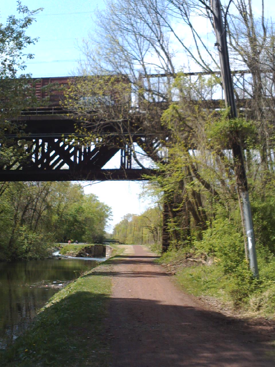
Looking upstream on the Delaware Canal a mile below Yardley PA. Portions of the canal are now holding water thanks to the extensive flood restoration that is nearing completion. When the Delaware Canal is operational it's primarily supplied with water from the Lehigh River, which joins the Delaware River at the Forks of the Delaware in the City of Easton. That's where the Lehigh Canal ends and the Delaware Canal begin

The Delaware River is back to a normal flow (long-term median); indeed at Belvidere it’s a little below normal for this date.

The weather has been streaky that way for many moons. Frequent and/or long lasting storms punctuated by glorious weather. Lately the glorious mode has been dominant.

And the reason for the Delaware’s long descent to somewhat below normal is the more sudden crash of many of the Pennsylvania tributaries like the Broadhead Creek, which is a few hundred cfs below the median. That’s the result of the unseasonably hot, dry windy weather we enjoyed.

The mighty Lehigh too is well below normal, a full 1000 cfs below at Bethlehem.

Down in the land of Triassic shale the Tohickon is at a summerlike trickle of 55 cfs, barely half the median flow for Tax Day.

On the Jersey side of the river, tributaries like the Flatbrook and Musconetcong River are near or slightly below the median.

The difference between the overall flow of the two states' tributaries is expressed in the rainfall distribution from the last nor’easter, which hammered the coast with up to 15 inches in some places, but only gave the Poconos and westernmost PA piedmont a paltry few inches by comparison.

And that’s the way it is. And as usual, changes are on the way.

Wednesday, March 31, 2010

Going down…

The Delaware River gage at Riegelsville shows the river is still surging up to 14’ (8’ short of flood stage).

It won’t crest and fall until most of the tributaries have done so, particularly the major streams like the Lehigh, Lackawaxen, and Musconetcong.

The Musconetcong River is still creeping up a bit but will fall far short of its 6’ flood stage. The Flatbrook, Paulinskill and Pequest have all flatlined or are falling.

The Lackawaxen has flatlined well below flood stage and most important of all, the Lehigh River at ‘O’ Little Town’ has turned the corner and crested. The Delaware River should soon crest near 14’.

It’s always interesting to note that – all things being equal – the Delaware River at Belvidere and Delaware River at Riegelsville typically run at the same level, and share the same flood stage number.

However, right now the river at Riegelsville is running 2’ higher than the upstream location. Most of that difference can be attributed to the Lehigh River, which joins the Delaware well below Belvidere and 9 miles upstream from Riegelsville. Note: The NYC reservoirs were full coming into the storm event.

As the second largest tributary to the Delaware River the Lehigh is the most important factor for both water quality and water quantity in the lower Delaware River below Easton.

We need a dry spell.

Monday, March 29, 2010

Nor’easter Express

Eddyphiles

Between two and four inches of rain with six inches in spots will make for some rip-roaring waterways.

The Delaware River at Riegelsville is already up to 10.21’ so a few more inches of rain could push it closer to flood stage than the last storm did (flood stage is 22’ @ Riegelsville). The Musconetcong River shot up to almost 4' overnight (1200 cfs) and while it's currently heading back down, another heavy dose of rain could take it out of its banks (6' is flood stage).

Last Saturday I spent the day staffing the DVD-ACA booth at The Jersey Paddler Expo, which was held at the the Garden State Expo Center. It was packed with people from all over the region (Lancaster, Dover, Cape May, NYC, etc.).

I fielded questions from folks interested in learning more about the Delaware River and other streams in the region, some wanted to know about camping opportunities, others about kayak instruction. The recent drowning in the Delaware River came up repeatedly. By the time the weekend ended I’m guessing we gave out several hundred copies of the Delaware River Water Trail Guide as well as ACA Safety brochures covering a variety of topics from cold water paddling to lowhead dams.

It’s clear that paddling (canoeing, kayaking and rafting) continues to grow in popularity and people are willing to spend money to pursue their passion. The potential constituency for river protection also continues to grow, although that will remain an untapped resource unless someone or some organization decides to reach out to this sleeping army of riverkeepers.

I am developing a mobilization and training program.

Friday, March 26, 2010

A Toh Day…

Toh Rocks

Paddlers can help the Pennsylvania Environmental Council improve the future of paddling on the tidal Delaware River by filling out a river recreation survey. Go to my FaceBook profile for a link. It takes about 10 minutes, is interesting and anonymous.

We had a mellow day on the Upper Tohickon Creek (yesterday) and it was running at a lazy 2.50’ or about 300 cfs. Chris Meyers and I paddled solo canoes and dawdled of wildlife and emerging spring foliage. Most conspicuous was the presence of lesser celadine. It’s an insidious invasive species with a pretty yellow flower. We observed a red tailed hawk fly over the creek with a young black snake in its clutch (lunch!), several wood duck, mergansers, and a trio of great blue heron.

Toh Drops

Wednesday, March 24, 2010

Tripping on the river...


I led a trip on the Musconetcong River for Watershed Association last Saturday and it was great to be out on my favorite little river again; it was the first Musky trip this year. The weather was unseasonably warm and that was a good thing because three of the paddlers had five unplanned swims between them.

The river was running at 700 cfs or 3' at the Bloomsbury stream gage which is a slightly "pushy" level. We ran the Beattystown to Point Mountain section and observed wood ducks and a breeding pair of common mergansers.

I took a ride upriver from Yardley to Riegelsville earlier this week and saw an osprey flying around the Riegelsville Bank with a fish in its claws. They are back nesting on the cell phone tower behind the bank.

Coming back down the Bucks County side it appears that the canal repairs are almost completed, with the section below New Hope still under construction. We now have water in the canal in Yardley for the first time since we moved here tow years ago. Nice amenity...

Sunday, March 14, 2010

Waters of March...

A quick look at the stream gages in the aftermath of a wicked nor'easter shows that several streams reached flood stage. Notable among these are the Flatbrook, Paulinskill, Pequest and Assunpink on the NJ side, and the Neshaminy and Brandywine on the PA side.

All the other usual suspects were ripping high but did not and will not flood this time (Musconetcong, Tohickon, Wickecheoke, etc.).

The Delaware River at Riegelsville is currently 15.18' or 7' below flood stage. It should crest tonight or tomorrow at around 18' (my unscientific estimate). The river is already nearing its crest point according to the Upper Delaware gages.

The Delaware River at Belvidere is only at 12.33' and it should be noted that - all things being equal - the gage usually reads about the same at both the Belvidere and R-ville locations and both have a 22' flood threshold. Why the three foot difference? Most likely the Lehigh River, which joins the Delaware below Belvidere, and influences the river below the confluence at Easton.

The Lehigh is already showing a drop at Lehighton, and it's just beginning to flatline at the Bethlehem gage. That's what we need to see before the Delaware River begins to level off.


Thursday, March 11, 2010

LATE WINTER FLOOD?

Will we have a late winter flood on the Delaware this coming Monday? Maybe, but last Monday was a perfect winter day to be out on the river with paddling buddy Chris Meyers. We saw two powerboats and nobody else ventured out on the water. The river was running just above 5’, which is a nice level for winter paddling.

Delaware

Delaware River near Devils Tea Table (March 1, 2010)

The river has steadily risen to over 6.75’ at the Riegelsville gage thanks to the warm weather and snow melt.

Next week is FLOOD SAFETY AWARENESS WEEK and if the impending storm acts as predicted floodplain dwellers will be acutely aware of flooding.

Rainfall in the amount of 2” to 4” is predicted for the Delaware River Basin and if it’s the higher amount many smaller streams could flood.Some locales could receive 5" or more.

Friends living along the Upper Delaware tell me that there isn’t much snow on the ground on the Catskill side of the river. I’m not sure if that applies to the Pocono Mountain side of the river. River ice appears to have disappeared. The three NYC reservoirs are down to 85% of capacity, which depending on where the rain falls, could help mitigate flooding on the Upper Delaware. NYC could lower the reservoirs to 50% and that would not necessarily eliminate the flood threat for those living below the confluence of the Delaware River and Lehigh River. The watershed of the Lehigh River alone is roughly equivalent in size to all three of the big reservoirs' watershed area combined.

Snow pack conditions in the East Branch Delaware and West Branch Delaware were “above normal” according to the National Weather Service Hydrologic Outlook report from Binghamton, NY (March 5). That has likely changed somewhat over the past several days, but this could still pose a major threat if heavy rain falls in the uppermost portion of the river basin.

There is probably some amount of snow left along the hemlock-shaded slopes of the tributary headwaters, and the ground is still fairly saturated; most of what falls on the watershed will rapidly runoff to the nearest waterway.

The Delaware River still has about 15’ to go to reach the top of its banks (at Riegelsville and Belvidere). I don’t expect that to happen unless rainfall amounts exceed what is predicted. Given that this storm will be a spinning nor’easter anything can happen. It’s certain that people will and should be nervous about the flooding potential.

It’s also certain that those of us who love to canoe and kayak will have lots of water for weeks to come.

Stay tuned, I’ll be updating the situation Saturday night or Sunday morning at the latest. In the meantime, visit the DRBC website for flood information.